Area Overview for NE29 7UP
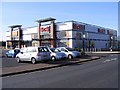
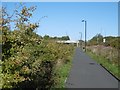
Photos of NE29 7UP


Area Information
Living in NE29 7UP means being part of a small, tightly knit residential cluster in England, where 1,431 residents share a population density of 1,030 people per square kilometre. This area is characterised by its modest scale, with homes predominantly in the form of houses rather than flats, reflecting a community that values private living spaces. The median age of 47 suggests a mature demographic, with adults aged 30–64 forming the largest group. Daily life here is shaped by proximity to essential services, including retail hubs like Tesco North and M&S Silverlink, and transport links such as the Percy Main metro station and nearby rail networks. While the area lacks natural beauty designations like AONBs or protected woodlands, its practical connectivity and access to schools like Collingwood Primary make it a viable choice for families seeking a balanced lifestyle. However, the high crime risk score of 19/100 underscores the need for vigilance, balancing the area’s conveniences with real-world considerations.
- Area Type
- Postcode
- Area Size
- Not available
- Population
- 1431
- Population Density
- 1030 people/km²
The property market in NE29 7UP is primarily owner-occupied, with 52% of homes owned by residents rather than rented. The accommodation type is almost exclusively houses, which is unusual for areas with higher flat density. This suggests a market catering to those seeking private, detached living spaces rather than apartments. Given the small population and limited area, the housing stock is likely constrained, meaning buyers should consider the scarcity of properties and potential competition. The predominance of houses may also indicate a focus on family homes, aligning with the area’s median age and adult demographic. However, the lack of data on property prices or recent sales trends means buyers must rely on local agents for up-to-date market insights. The small size of NE29 7UP means the immediate surroundings may offer more options, but proximity to amenities like schools and transport remains a key selling point.
House Prices in NE29 7UP
No properties found in this postcode.
Energy Efficiency in NE29 7UP
The lifestyle in NE29 7UP is shaped by its proximity to retail, transport, and community hubs. Residents can access five retail outlets, including Tesco North, Iceland North, and M&S Silverlink, offering everyday shopping needs. The area’s transport network includes five metro stations, five rail stations, and two ferry terminals, facilitating travel to nearby towns and cities. For leisure, the presence of multiple stations like Percy Main and Howdon suggests easy access to local amenities, though specific parks or recreational areas are not detailed in the data. The variety of transport and retail options contributes to a convenient, functional lifestyle, though the area’s small size means residents may need to venture further for broader entertainment or cultural offerings. The mix of retail, transport, and community infrastructure supports a practical, everyday rhythm of life.
Amenities
Schools
Residents of NE29 7UP have access to two primary schools: Collingwood Primary School and Norham High School, both rated ‘good’ by Ofsted. While both are listed as primary schools, their presence ensures families have options for early education. The availability of two primary schools within practical reach is a significant advantage, reducing the need for long commutes. However, the absence of secondary school data means parents may need to look beyond the immediate area for secondary education. The ‘good’ Ofsted ratings suggest a baseline standard of teaching and facilities, though specific details on curriculum or extracurriculars are not provided. For families prioritising primary education, this area offers a reliable start, but further research into secondary options is necessary for long-term planning.
| Rank | School | Type | Entry gender | Ages |
|---|
Explore more schools in this area
Go to Schools tabDemographics
NE29 7UP’s population of 1,431 is predominantly White, with 52% of residents owning their homes. The median age of 47 indicates a community skewed towards middle-aged adults, with the 30–64 age group forming the majority. This suggests a stable, established population with fewer young families or retirees compared to other areas. The high home ownership rate and prevalence of houses over flats reflect a preference for private, long-term residency. However, the lack of specific data on household types or deprivation levels means the area’s socioeconomic diversity remains unclear. The absence of significant ethnic diversity, as noted by the predominant White population, may influence the cultural landscape. For buyers, this demographic profile implies a community with a focus on stability and continuity, though the limited data on diversity or deprivation means further local research may be needed to fully understand the social dynamics.
Household Size
Accommodation Type
Tenure
Ethnic Group
Religion
Household Composition
Age
Household Deprivation
NS-SEC
Explore more demographic insights in this area
Go to Demographics tabPlanning
Planning Constraints
- Flood RiskPremium
- Ramsar Wetland SitesPremium
- Area of Outstanding Natural BeautyPremium
- Protected Nature ReservePremium
- Protected WoodlandPremium