Area Overview for NE29 7UB
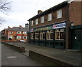
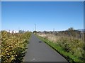
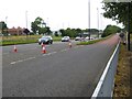
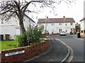
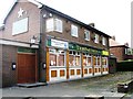
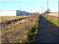
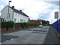
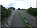
Photos of NE29 7UB


Area Information
NE29 7UB is a small, tightly knit residential postcode in England, home to 1,431 people spread across a compact area with a population density of 1,030 people per square kilometre. This cluster of homes reflects a mature community, with a median age of 47 and a majority of residents aged 30–64. The area’s character is defined by its focus on owner-occupied housing, with 52% of properties owned by residents rather than rented. While it lacks the sprawling infrastructure of larger towns, its proximity to transport links and amenities makes it a practical choice for those prioritising convenience. Daily life here balances suburban tranquillity with access to essential services. However, the area’s small size means its appeal is niche—ideal for those seeking a close-knit environment but not suited to those needing expansive space. The absence of major planning constraints, such as protected landscapes or wetlands, ensures development remains straightforward, though the high crime risk score of 19/100 demands caution. For buyers, NE29 7UB offers a snapshot of a specific type of English suburb: modest, functional, and defined by its immediate surroundings.
- Area Type
- Postcode
- Area Size
- Not available
- Population
- 1431
- Population Density
- 1030 people/km²
NE29 7UB is primarily an owner-occupied area, with 52% of properties owned by residents. The housing stock consists mostly of houses, which is unusual for a small postcode but suggests a focus on family-friendly, single-unit dwellings. This configuration implies a limited rental market, as the proportion of owner-occupied homes is significantly higher than the UK average. The area’s small size means the property market is tightly contained, with few options beyond the immediate cluster. For buyers, this presents both opportunities and challenges: the availability of houses may appeal to those seeking space, but the lack of diversity in housing types could limit choices. Proximity to transport links and amenities may offset the area’s compact nature, though the high crime risk score of 19/100 could deter some. Overall, the market reflects a niche demand for homes in a specific, low-density environment.
House Prices in NE29 7UB
No properties found in this postcode.
Energy Efficiency in NE29 7UB
Residents of NE29 7UB benefit from a range of nearby amenities, including five retail outlets such as Tesco North, Iceland North, and M&S Silverlink. These shops provide everyday essentials, while the proximity to five metro stations, five rail stops, and two ferry terminals ensures easy access to broader networks. The ferry terminals at Newcastle and South Shields offer direct links to nearby towns, enhancing connectivity. For leisure, the area’s transport links open doors to larger cities and attractions, though local parks or recreational spaces are not named in the data. The presence of multiple transport options and retail hubs suggests a practical, convenience-driven lifestyle. However, the absence of named parks or leisure facilities means the area’s recreational offerings are not detailed. Overall, NE29 7UB caters to those prioritising accessibility over expansive green spaces.
Amenities
Schools
Residents of NE29 7UB have access to two schools with good Ofsted ratings: Collingwood Primary School and Norham High School. Both institutions provide a solid foundation for education, though the data specifies neither as a secondary school, which may limit options for older children. The presence of two primary schools suggests a focus on early education, but families requiring secondary schooling may need to look beyond the immediate area. The lack of named secondary schools in the data means the full educational landscape is unclear. For those prioritising primary education, the good ratings indicate reliable teaching standards. However, the absence of detailed information on school capacity, catchment areas, or additional facilities means prospective buyers should investigate further to ensure their children’s needs are fully met.
| Rank | School | Type | Entry gender | Ages |
|---|
Explore more schools in this area
Go to Schools tabDemographics
The population of NE29 7UB is predominantly composed of adults aged 30–64, with a median age of 47. This suggests a community of established professionals and families, rather than a younger or elderly demographic. Home ownership is strong here, with 52% of residents owning their homes, a figure that indicates a stable, long-term presence. The area’s accommodation is largely made up of houses, reflecting a preference for single-family living over flats or apartments. The predominant ethnic group is White, which aligns with broader regional trends. While no specific data on deprivation is provided, the high home ownership rate and mature age profile suggest a relatively stable economic environment. However, the absence of detailed diversity metrics means the full scope of the community’s social fabric remains unclear. For prospective buyers, the area’s demographic profile indicates a focus on practicality and permanence, with little evidence of transient or rental-driven populations.
Household Size
Accommodation Type
Tenure
Ethnic Group
Religion
Household Composition
Age
Household Deprivation
NS-SEC
Explore more demographic insights in this area
Go to Demographics tabPlanning
Planning Constraints
- Flood RiskPremium
- Ramsar Wetland SitesPremium
- Area of Outstanding Natural BeautyPremium
- Protected Nature ReservePremium
- Protected WoodlandPremium