Area Overview for NE29 7TZ
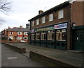
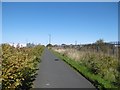
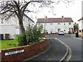
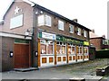
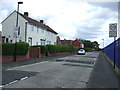
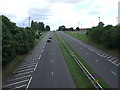
Photos of NE29 7TZ


Area Information
NE29 7TZ is a small, tightly packed residential postcode in England, home to 1,431 people spread across a compact area with a population density of 1,030 people per square kilometre. This is a community defined by its proximity to practical amenities and transport links, making it a convenient base for those prioritising accessibility. The area’s character is shaped by its mature demographic, with a median age of 47 and a majority of residents aged 30–64. Daily life here is anchored by local services, with shops, schools, and public transport within reach. While the postcode is small, it connects to broader networks, including rail, ferry, and metro stations, offering flexibility for commuters. The housing stock is predominantly owner-occupied, with a focus on family homes, reflecting the area’s stability. For buyers, NE29 7TZ offers a blend of practicality and community, though its limited size means choices are constrained to a specific cluster of properties.
- Area Type
- Postcode
- Area Size
- Not available
- Population
- 1431
- Population Density
- 1030 people/km²
The property market in NE29 7TZ is characterised by a 52% home ownership rate, with houses forming the majority of the housing stock. This suggests a focus on owner-occupied properties rather than a rental market, though the exact proportion of rental homes is not specified. The small size of the postcode means the available housing is limited to a specific cluster, which may restrict choice for buyers. The predominance of houses indicates a preference for family homes, potentially appealing to those seeking space and stability. However, the area’s compact nature means buyers must consider the immediate surroundings for additional options. The market likely reflects the broader trends of the region, with property values influenced by proximity to transport links and local amenities.
House Prices in NE29 7TZ
No properties found in this postcode.
Energy Efficiency in NE29 7TZ
The lifestyle in NE29 7TZ is supported by a range of nearby amenities, including five retail outlets such as Iceland North, Tesco North, and M&S Silverlink, which cater to everyday shopping needs. The area’s proximity to five metro stations, five rail stops, and two ferry terminals ensures easy access to transport hubs, enhancing mobility. For leisure, the nearby towns of Percy Main, Meadow Well, and Howdon may offer additional facilities, though specific details are not provided. The presence of multiple transport options and retail venues suggests a practical, convenience-focused lifestyle, with residents able to access services without long journeys. The mix of shops, transport, and connectivity creates a functional environment suited to those prioritising accessibility and efficiency.
Amenities
Schools
Residents of NE29 7TZ have access to two primary schools: Collingwood Primary School and Norham High School, both of which hold a good Ofsted rating. This ensures families can secure quality early education within the area, reducing the need for long commutes. The presence of two primary schools suggests a focus on local schooling, though no secondary schools are listed in the data. For families requiring secondary education, nearby towns or larger centres may be necessary. The good Ofsted ratings indicate that these schools meet national standards in teaching and pupil outcomes, providing reassurance for parents. The mix of primary schools also allows for some choice, though the limited number of institutions may necessitate planning for future school placements.
| Rank | School | Type | Entry gender | Ages |
|---|
Explore more schools in this area
Go to Schools tabDemographics
The community in NE29 7TZ is predominantly composed of adults aged 30–64, with a median age of 47. This suggests a mature, established population, likely with long-term ties to the area. Home ownership rates stand at 52%, indicating a mix of owner-occupied and rental properties, though the latter is not explicitly quantified. The primary accommodation type is houses, which aligns with the area’s focus on family homes. The predominant ethnic group is White, though no data is provided on minority representation. The demographic profile implies a stable, low-turnover community, with residents likely prioritising proximity to schools, transport, and local services. The absence of specific data on deprivation or income levels means the area’s quality of life is inferred from its infrastructure and amenities rather than socioeconomic metrics.
Household Size
Accommodation Type
Tenure
Ethnic Group
Religion
Household Composition
Age
Household Deprivation
NS-SEC
Explore more demographic insights in this area
Go to Demographics tabPlanning
Planning Constraints
- Flood RiskPremium
- Ramsar Wetland SitesPremium
- Area of Outstanding Natural BeautyPremium
- Protected Nature ReservePremium
- Protected WoodlandPremium