Area Overview for NE29 7TW
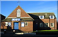
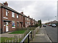
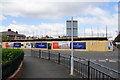
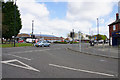
Photos of NE29 7TW


Area Information
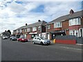
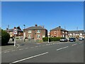
Living in NE29 7TW offers a compact, tightly knit residential experience within a small cluster of homes. With a population of 1,431 and a density of 1,030 people per square kilometre, this area balances proximity with a sense of community. The median age of 47 suggests a mature demographic, with most residents falling between 30 and 64 years old. Daily life here is shaped by proximity to essential services, including retail hubs like Tesco North and Spar, as well as transport links that connect to nearby towns. The area’s housing stock is dominated by individual homes, with 52% owner-occupied properties, reflecting a mix of long-term residents and those seeking stable living. While the postcode lacks natural constraints like protected woodlands or AONB designations, its practical advantages—such as ferry access to Newcastle and rail connections to Meadow Well—make it appealing for commuters. For those prioritising convenience over sprawling landscapes, NE29 7TW provides a functional base with a straightforward, no-frills lifestyle.
- Area Type
- Postcode
- Area Size
- Not available
- Population
- 1431
- Population Density
- 1030 people/km²
The property market in NE29 7TW is characterised by a focus on individual homes, with 52% of properties owner-occupied. This suggests a stable, long-term resident base rather than a high turnover of rental properties. The dominance of houses over flats or apartments means the area caters to those seeking private, family-friendly living spaces. Given the small size of the postcode, the housing stock is limited, which may make the market competitive for buyers. The 52% home ownership rate also implies that a significant portion of properties are rented, potentially offering opportunities for investors. However, the small scale of the area means buyers should consider proximity to nearby towns for additional options. For those prioritising privacy and space, NE29 7TW’s housing stock aligns with these needs, though the limited number of properties may require a broader search beyond the immediate postcode.
House Prices in NE29 7TW
No properties found in this postcode.
Energy Efficiency in NE29 7TW
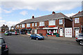
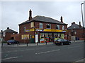
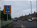
Residents of NE29 7TW enjoy a range of amenities within practical reach, from retail to transport. The area’s retail options include major chains like Tesco North, Spar, and Aldi Howdon, ensuring everyday shopping needs are met. For travel, the postcode’s proximity to Percy Main, Howdon, and Meadow Well metro stations, along with rail links to Newcastle, provides seamless access to urban centres. Ferry terminals at Newcastle International and South Shields offer direct coastal travel, while bus routes like Rhodes Street connect to local hubs. The absence of major parks or leisure facilities within the postcode means residents may need to travel to nearby towns for recreational activities. However, the compact layout of NE29 7TW ensures that essential services are within walking or short driving distance, contributing to a convenient, low-maintenance lifestyle. The blend of retail, transport, and commuter links makes daily life here efficient, though those seeking extensive leisure options may need to look beyond the immediate area.
Amenities
Schools
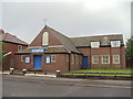
Residents of NE29 7TW have access to two primary schools: Collingwood Primary School and Norham High School, both rated ‘good’ by Ofsted. While both institutions are categorised as primary schools, their presence ensures a range of educational options for younger children. The availability of two primary schools within practical reach supports families seeking proximity to schooling without the need for long commutes. However, the absence of secondary schools in the immediate area may require students to travel to nearby towns for higher education. The ‘good’ Ofsted ratings indicate that both schools meet national standards, though parents may need to consider additional factors such as catchment areas or school capacity when planning their move. For families prioritising primary education, NE29 7TW offers reliable, well-rated options.
| Rank | School | Type | Entry gender | Ages |
|---|
Explore more schools in this area
Go to Schools tabDemographics
NE29 7TW’s population of 1,431 is predominantly composed of adults aged 30 to 64, with a median age of 47. This suggests a community of established professionals and families, rather than a transient or student-heavy population. Home ownership rates stand at 52%, indicating a balance between owner-occupied properties and rental units. The area’s accommodation type is primarily houses, which aligns with the demographic profile of older, settled residents. The predominant ethnic group is White, reflecting the broader regional composition. The population density of 1,030 people per square kilometre implies a compact, closely spaced living environment. While no specific deprivation data is provided, the mix of home ownership and rental properties suggests a moderate range of economic backgrounds. The absence of significant age groups under 18 or over 65 may indicate a community focused on middle-aged households, with fewer childcare or retirement-specific needs.
Household Size
Accommodation Type
Tenure
Ethnic Group
Religion
Household Composition
Age
Household Deprivation
NS-SEC
Explore more demographic insights in this area
Go to Demographics tabPlanning
Planning Constraints
- Flood RiskPremium
- Ramsar Wetland SitesPremium
- Area of Outstanding Natural BeautyPremium
- Protected Nature ReservePremium
- Protected WoodlandPremium