Area Overview for NE29 7TS
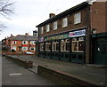
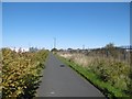
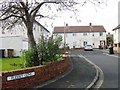
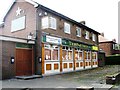
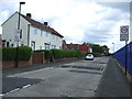
Photos of NE29 7TS


Area Information
Living in NE29 7TS means being part of a compact, residential cluster in northeast England with a population of 1,431 people. The area’s density of 1,030 people per square kilometre suggests a tightly woven community, where proximity to amenities and transport hubs is a defining feature. This postcode is not a sprawling suburb but a focused cluster of homes, likely centred around local services and green spaces. The median age of 47 and a population skewed towards adults aged 30–64 indicate a stable, mature demographic, with families and professionals making up the core of the community. Daily life here is shaped by practical needs—access to schools, retail, and transport is critical. While the area lacks the vibrancy of a city centre, its small size means residents can reach key services within short distances. The mix of housing types and ownership levels suggests a balance between long-term residents and those seeking a quieter, more manageable environment. For buyers, NE29 7TS offers a snapshot of a specific, defined postcode where every element of life is within arm’s reach.
- Area Type
- Postcode
- Area Size
- Not available
- Population
- 1431
- Population Density
- 1030 people/km²
The property market in NE29 7TS is characterised by a 52% home ownership rate, with houses forming the predominant accommodation type. This suggests a community where long-term residency is common, though the area is not dominated by rental properties. The small size of the postcode means the housing stock is limited, which could make the market competitive for buyers seeking specific types of homes. Given the focus on houses, the area may appeal to families or those prioritising space and privacy. However, the lack of detailed data on property prices or availability means buyers must consider the broader context of nearby areas. The proximity to transport hubs and amenities may enhance the area’s appeal, but its compact nature means potential buyers should evaluate whether the immediate surroundings meet their needs. For those seeking a quieter, more established environment, NE29 7TS offers a focused, residential option.
House Prices in NE29 7TS
No properties found in this postcode.
Energy Efficiency in NE29 7TS
Residents of NE29 7TS have access to a range of nearby amenities, from retail to transport. The area’s retail options include Iceland North, Tesco North, and M&S Silverlink, providing essential shopping and dining choices. Metro stations such as Percy Main, Meadow Well, and Howdon offer easy access to public transport, while rail services at Railway Station, Brockley Whins, and East Boldon connect to broader networks. Ferry terminals in Newcastle and South Shields add flexibility for travel by water. The presence of multiple transport options ensures residents can reach work, leisure, or social destinations with ease. Though the area is small, its proximity to these amenities suggests a practical, service-oriented lifestyle. The mix of retail, transport, and connectivity options supports both daily needs and the ability to engage with wider regional opportunities.
Amenities
Schools
Residents of NE29 7TS have access to two primary schools: Collingwood Primary School and Norham High School, both of which hold a ‘good’ Ofsted rating. The presence of two primary schools suggests a focus on early education, though no secondary schools are listed in the data. This could mean families may need to travel to nearby areas for secondary education, depending on their specific needs. The ‘good’ ratings indicate that both schools meet acceptable standards, though further details on curriculum, student outcomes, or facilities are not provided. For parents prioritising primary education, the availability of two schools within reach offers some flexibility, but the absence of secondary options may require careful planning. The proximity of these schools to homes in NE29 7TS underscores the area’s suitability for families seeking a stable, service-oriented environment.
| Rank | School | Type | Entry gender | Ages |
|---|
Explore more schools in this area
Go to Schools tabDemographics
The community in NE29 7TS is predominantly composed of adults aged 30–64, with a median age of 47. This suggests a population that is largely in their prime working years, potentially stabilising the area’s economic and social dynamics. Home ownership stands at 52%, indicating a mix of owner-occupied properties and rental homes. The accommodation type is primarily houses, which may reflect a preference for family-friendly living spaces. The predominant ethnic group is White, though no specific diversity statistics are provided. The absence of data on deprivation or income levels means the area’s quality of life cannot be fully assessed, but the age profile and home ownership suggest a community that is neither overwhelmingly young nor elderly. With a population of 1,431, the area is small enough to foster a sense of familiarity, yet it is not isolated—its proximity to transport links and amenities ensures residents are connected to broader networks.
Household Size
Accommodation Type
Tenure
Ethnic Group
Religion
Household Composition
Age
Household Deprivation
NS-SEC
Explore more demographic insights in this area
Go to Demographics tabPlanning
Planning Constraints
- Flood RiskPremium
- Ramsar Wetland SitesPremium
- Area of Outstanding Natural BeautyPremium
- Protected Nature ReservePremium
- Protected WoodlandPremium