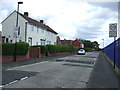
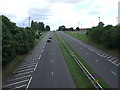
Area Overview for NE29 7TL
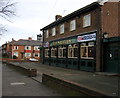
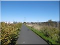
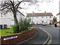
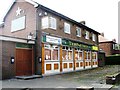
Photos of NE29 7TL


Area Information
Living in NE29 7TL means being part of a small, tightly knit residential cluster in England. With a population of 1,431 and a density of 1,030 people per square kilometre, this area is compact yet functional. The community is characterised by its mix of family homes and a median age of 47, suggesting a stable, mature demographic. Daily life is shaped by proximity to essential services, including retail hubs like Tesco North and M&S Silverlink, and transport links such as the Percy Main metro station. While the area lacks natural beauty designations, its practicality is evident in the ease of access to schools, rail, and ferry terminals. The low flood risk and absence of protected land constraints mean development is unencumbered, though crime rates are notably high. For those prioritising convenience and connectivity over rural tranquillity, NE29 7TL offers a straightforward, no-frills lifestyle with clear advantages in mobility and accessibility.
- Area Type
- Postcode
- Area Size
- Not available
- Population
- 1431
- Population Density
- 1030 people/km²
The property market in NE29 7TL is dominated by owner-occupied homes, with 52% of residents owning their properties. This contrasts with areas where rental demand drives the market, suggesting a more settled population. The accommodation type is primarily houses, which is unusual for a small postcode area but may reflect a focus on family homes or larger properties. Given the compact size of NE29 7TL, the housing stock is likely limited, making it a niche market for buyers seeking specific properties. The absence of high-density housing or commercial developments means the area is unlikely to attract speculative investment. For those considering purchase, the emphasis on houses may appeal to families but could limit options for first-time buyers or those seeking flats.
House Prices in NE29 7TL
No properties found in this postcode.
Energy Efficiency in NE29 7TL
The lifestyle in NE29 7TL is defined by its proximity to retail, transport, and leisure. Within practical reach are five retail outlets, including Tesco North and Iceland North, offering everyday shopping needs. The area’s five metro stations and rail links provide swift access to nearby towns, while ferry terminals connect to Newcastle and South Shields. For leisure, the mix of transport hubs and retail options suggests a practical, urban-oriented lifestyle. However, the absence of named parks or recreational facilities means outdoor activities may require travel. The presence of multiple transport options and shops ensures convenience, though the area lacks distinct cultural or natural attractions.
Amenities
Schools
Residents of NE29 7TL have access to two primary schools: Collingwood Primary School and Norham High School, both rated ‘good’ by Ofsted. While both are categorised as primary schools, the presence of two options within the area provides families with choices for early education. The lack of secondary schools nearby means parents may need to consider commuting for older children, though the proximity to rail and metro stations could ease this. The ‘good’ Ofsted ratings suggest a baseline standard of education, but the absence of specialist or high-achieving institutions is notable. For families prioritising primary education, the schools in NE29 7TL offer reliable, if unremarkable, options.
| Rank | School | Type | Entry gender | Ages |
|---|
Explore more schools in this area
Go to Schools tabDemographics
The population of NE29 7TL skews towards adults aged 30–64, with a median age of 47. This suggests a community of established professionals and families, rather than a transient or student demographic. Home ownership stands at 52%, indicating a balance between owner-occupied properties and rentals. The predominant accommodation type is houses, which aligns with the area’s low population density and suggests a preference for standalone living. The majority of residents identify as White, reflecting a homogenous ethnic profile. While no specific deprivation data is provided, the high home ownership rate and mature age range imply a relatively stable economic environment. However, the absence of detailed diversity metrics means the full breadth of the community’s social fabric remains unexplored.
Household Size
Accommodation Type
Tenure
Ethnic Group
Religion
Household Composition
Age
Household Deprivation
NS-SEC
Explore more demographic insights in this area
Go to Demographics tabPlanning
Planning Constraints
- Flood RiskPremium
- Ramsar Wetland SitesPremium
- Area of Outstanding Natural BeautyPremium
- Protected Nature ReservePremium
- Protected WoodlandPremium