Area Overview for NE29 7TH
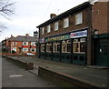
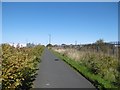
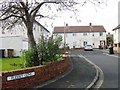
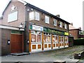
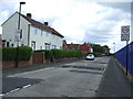
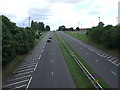
Photos of NE29 7TH


Area Information
NE29 7TH is a small, tightly knit residential postcode in England, home to 1431 people spread across a compact area with a population density of 1030 people per square kilometre. This is a community-oriented cluster, where daily life is shaped by proximity to essential services and transport links. The area’s character is defined by its mix of older and newer housing stock, with a focus on family-friendly living. Residents benefit from nearby schools, retail hubs, and public transport options, making it a practical choice for those prioritising convenience. While the population is relatively small, the density suggests a balance between private homes and shared spaces. The area’s appeal lies in its accessibility to larger urban centres, combined with a quieter, residential atmosphere. For buyers, the limited size of NE29 7TH means properties are likely to be in close proximity to each other, offering a sense of familiarity and community. The postcode’s compact nature also ensures that amenities are within walking or short driving distance, reducing the need for long commutes.
- Area Type
- Postcode
- Area Size
- Not available
- Population
- 1431
- Population Density
- 1030 people/km²
NE29 7TH is predominantly a home-owning area, with 52% of residents owning their properties. The accommodation type is largely houses, which contrasts with areas where flats or apartments dominate. This suggests a market skewed towards owner-occupied homes rather than rental properties, potentially limiting the availability of short-term or lettings-based options. The focus on houses may appeal to buyers seeking more space or a traditional residential layout, though the small size of the postcode means the housing stock is likely limited in number. For buyers, this could mean competition for available properties, especially as the area’s proximity to amenities and transport links may make it attractive. The lack of flats or high-density housing also indicates that the area is not a hub for younger professionals or students, but rather a place suited to families or those prioritising private, standalone homes.
House Prices in NE29 7TH
No properties found in this postcode.
Energy Efficiency in NE29 7TH
The lifestyle in NE29 7TH is shaped by its proximity to a range of retail, dining, and transport hubs. Nearby retail options include Iceland North, Tesco North, and M&S Silverlink, offering a mix of supermarket and high-street shopping. The area’s transport network includes five metro stations, five rail stations, and two ferry terminals, providing seamless access to both urban and coastal destinations. While the data does not specify parks or leisure facilities, the density of amenities suggests a focus on convenience over expansive green spaces. Residents can access daily essentials, public transport, and regional connectivity without long journeys. The presence of multiple retail and transport options indicates a practical, service-oriented lifestyle, though the lack of detailed information on leisure facilities means the area’s recreational offerings remain unclear.
Amenities
Schools
Residents of NE29 7TH have access to two primary schools: Collingwood Primary School and Norham High School, both of which hold an Ofsted rating of ‘good’. These institutions provide a foundation for early education and are likely to be central to family life in the area. The presence of two primary schools within reach suggests that the community is designed to support local education, though no secondary schools are listed in the data. For families requiring primary schooling, this is a positive factor, but those needing secondary education may need to look further afield. The ‘good’ Ofsted ratings indicate that these schools meet acceptable standards, though specific details on curriculum, facilities, or student outcomes are not provided. The availability of primary schools reinforces the area’s appeal to households with children, particularly those prioritising proximity to educational institutions.
| Rank | School | Type | Entry gender | Ages |
|---|
Explore more schools in this area
Go to Schools tabDemographics
The population of NE29 7TH skews towards adults aged 30–64, with a median age of 47. This suggests a mature, stable community with a focus on established households rather than younger families or retirees. Home ownership rates stand at 52%, indicating a mix of owner-occupied properties and rental units, though the majority of homes are houses rather than flats or apartments. The predominant ethnic group is White, reflecting a homogenous demographic profile. The age range and home ownership figures suggest a population that is largely settled, with fewer transient residents. This stability may contribute to a sense of continuity in the area. However, the lack of specific data on deprivation or diversity means the community’s socioeconomic profile remains less defined. The presence of primary schools and transport links implies that the area is designed to support family living, though further details on household composition or income levels are not provided.
Household Size
Accommodation Type
Tenure
Ethnic Group
Religion
Household Composition
Age
Household Deprivation
NS-SEC
Explore more demographic insights in this area
Go to Demographics tabPlanning
Planning Constraints
- Flood RiskPremium
- Ramsar Wetland SitesPremium
- Area of Outstanding Natural BeautyPremium
- Protected Nature ReservePremium
- Protected WoodlandPremium