Area Overview for NE29 7TB
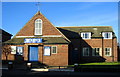
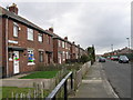
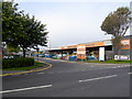
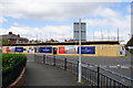
Photos of NE29 7TB

Area Information
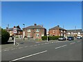
NE29 7TB is a compact residential postcode in England, home to 1,431 people spread across a densely populated area of just over 1.38 square kilometres. This small cluster of homes reflects a mature community, with a median age of 47 and a majority of residents aged between 30 and 64. The area is defined by its proximity to essential services and transport links, making it practical for daily life. While the population density is high, the postcode’s size means it is tightly woven into the surrounding infrastructure. Residents benefit from nearby schools, retail outlets, and multiple transport options, including rail, metro, and ferry access. The area’s character is shaped by its balance of suburban convenience and accessibility to larger urban hubs. For those seeking a community with established amenities and a focus on practical living, NE29 7TB offers a mix of stability and connectivity. However, its small size means the housing market is limited, requiring buyers to consider nearby areas for more options.
- Area Type
- Postcode
- Area Size
- Not available
- Population
- 1431
- Population Density
- 1030 people/km²
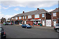
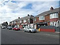
The property market in NE29 7TB is characterised by a 52% home ownership rate, meaning just over half of residents live in owner-occupied homes. The accommodation type is predominantly houses, which suggests the area is less focused on flats or apartments and more suited to family homes. This mix of ownership and rental tenure indicates a balance between long-term residents and those in more transient housing situations. Given the small size of the postcode, the housing stock is limited, and buyers may need to look beyond NE29 7TB for a broader selection of properties. The predominance of houses may appeal to those seeking space and privacy, but the area’s compact nature could limit availability. For investors, the market may be niche, with fewer properties coming to market compared to larger postcode areas. Buyers should consider nearby zones for more options, though the existing stock reflects a stable, mature community with established housing.
House Prices in NE29 7TB
No properties found in this postcode.
Energy Efficiency in NE29 7TB
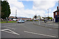
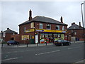
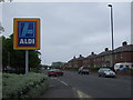
Daily life in NE29 7TB is supported by a range of nearby amenities. Retail options include Spar, Aldi Howdon, and Tesco North, offering convenience for grocery shopping and everyday needs. The area’s transport links—rail, metro, ferry, and bus—ensure residents can easily access larger urban centres or nearby towns. While the data does not specify parks or leisure facilities, the proximity to multiple transport hubs suggests the area is well-integrated into regional amenities. The presence of two primary schools and a dense network of services indicates a focus on practicality and accessibility. For residents, this means a lifestyle that balances local convenience with the ability to engage with broader opportunities. The compact nature of the postcode ensures that essential services are within walking or short-vehicle distance, enhancing the area’s appeal for those prioritising ease of access.
Amenities
Schools
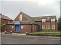
Residents of NE29 7TB have access to two primary schools with good Ofsted ratings: Collingwood Primary School and Norham High School. Both institutions provide quality education for younger children, ensuring families have options for their children’s early schooling. The presence of two primary schools within reach reduces the need for long commutes, a practical consideration for parents. While the data does not specify secondary schools, the availability of well-rated primary education suggests the area is family-friendly, with a focus on supporting children’s education from an early age. The good Ofsted ratings indicate that these schools meet or exceed national standards, which is a key factor for many homebuyers. For families prioritising education, NE29 7TB offers accessible, reputable primary schooling.
| Rank | School | Type | Entry gender | Ages |
|---|
Explore more schools in this area
Go to Schools tabDemographics
The population of NE29 7TB is predominantly composed of adults aged 30 to 64, with a median age of 47. This suggests a community that is largely settled, with fewer young families or retirees compared to other areas. Home ownership stands at 52%, indicating that nearly half of residents live in properties they own, while the remaining 48% are likely to be renters or in other tenure types. The accommodation type is primarily houses, which aligns with the demographic profile of older, more established households. The predominant ethnic group is White, with no data provided on other groups. The high population density of 1,030 people per square kilometre implies a compact, possibly mixed-use area where residential properties are closely spaced. This density may influence local amenities and services, ensuring they cater to a concentrated population. The age profile and ownership rates suggest a community that prioritises stability over rapid change, with a focus on long-term residency.
Household Size
Accommodation Type
Tenure
Ethnic Group
Religion
Household Composition
Age
Household Deprivation
NS-SEC
Explore more demographic insights in this area
Go to Demographics tabPlanning
Planning Constraints
- Flood RiskPremium
- Ramsar Wetland SitesPremium
- Area of Outstanding Natural BeautyPremium
- Protected Nature ReservePremium
- Protected WoodlandPremium