Area Overview for NE29 7SS
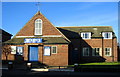
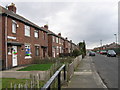
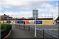
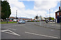
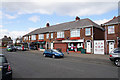
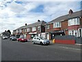
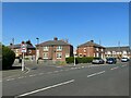
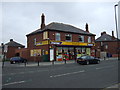
Photos of NE29 7SS


Area Information
NE29 7SS is a small, tightly knit residential postcode in England, home to 1,431 people spread across a densely populated area. With a population density of 1,030 people per square kilometre, this cluster of homes reflects a compact, community-focused lifestyle. The area is characterised by its mix of older and newer housing stock, with a strong emphasis on family-oriented living. Residents here are predominantly adults aged 30 to 64, creating a mature, stable demographic. The postcode’s proximity to key transport links and local amenities makes it practical for daily life, while its relatively low flood risk and absence of environmental constraints offer reassurance for long-term living. Although the area is small, its strategic location near major cities and transport hubs ensures easy access to broader opportunities. For those seeking a balance between residential comfort and connectivity, NE29 7SS presents a focused, manageable environment.
- Area Type
- Postcode
- Area Size
- Not available
- Population
- 1431
- Population Density
- 1030 people/km²
The property market in NE29 7SS is defined by a 52% home ownership rate, suggesting a balance between owner-occupied homes and rental properties. The accommodation type is predominantly houses, which implies a focus on family-friendly or larger living spaces rather than apartments or flats. This is typical of areas with older housing stock, where semi-detached or detached homes are common. Given the postcode’s small size, the housing stock is limited, making it a niche market for buyers seeking specific properties. The presence of houses rather than flats may appeal to those prioritising space and privacy. However, the relatively high population density suggests that properties are likely to be modest in size, with limited scope for expansion. Buyers should consider the proximity to transport and amenities, as these are key factors in the area’s appeal.
House Prices in NE29 7SS
No properties found in this postcode.
Energy Efficiency in NE29 7SS
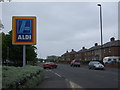
Living in NE29 7SS offers access to a range of practical amenities within walking or short driving distance. The area has five retail outlets, including Tesco North, Spar, and Aldi Howdon, ensuring everyday shopping needs are met. Transport links are robust, with metro stations at Percy Main, Howdon, and Meadow Well, as well as railway stations at Brockley Whins and Heworth. Ferry services to Newcastle and South Shields provide additional connectivity. While the data does not specify leisure or park facilities, the proximity to multiple transport hubs and retail options suggests a lifestyle focused on convenience and accessibility. The presence of multiple rail and ferry options also implies opportunities for commuting or weekend travel.
Amenities
Schools
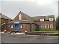
Residents of NE29 7SS have access to two primary schools: Collingwood Primary School and Norham High School, both of which hold a ‘good’ Ofsted rating. This ensures a reliable standard of education for young children, though the absence of secondary schools in the immediate area means families may need to consider commuting for older students. The presence of two primary schools suggests a focus on early education, which is beneficial for families with young children. However, the data does not specify the number of students per school or their proximity to individual properties. For those prioritising primary education, the ‘good’ ratings provide confidence in the quality of teaching and facilities.
| Rank | School | Type | Entry gender | Ages |
|---|
Explore more schools in this area
Go to Schools tabDemographics
The population of NE29 7SS is predominantly adults aged 30 to 64, with a median age of 47. This suggests a community of established professionals and families, rather than a younger or retired demographic. Home ownership sits at 52%, indicating a mix of owner-occupied properties and rental units, though not a heavily rented area. The accommodation type is primarily houses, which aligns with the higher proportion of family households. The predominant ethnic group is White, reflecting the broader regional profile. With 1,431 residents in a small area, the community is close-knit but not overly dense. The high population density of 1,030/km² means living spaces are compact, which could influence property sizes and layouts. This demographic profile suggests a stable, low-turnover environment, though the lack of specific data on deprivation or diversity means broader contextual analysis remains limited.
Household Size
Accommodation Type
Tenure
Ethnic Group
Religion
Household Composition
Age
Household Deprivation
NS-SEC
Explore more demographic insights in this area
Go to Demographics tabPlanning
Planning Constraints
- Flood RiskPremium
- Ramsar Wetland SitesPremium
- Area of Outstanding Natural BeautyPremium
- Protected Nature ReservePremium
- Protected WoodlandPremium