Area Overview for NE29 7SP
Photos of NE29 7SP


Area Information
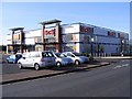
NE29 7SP is a compact residential postcode in England, home to 1,431 people spread across a densely populated area of 1030 people per square kilometre. This small cluster of homes reflects a mature community, with a median age of 47 and a strong presence of adults aged 30–64. The area’s character is defined by its proximity to essential services and transport links, making it a practical choice for those prioritising convenience. Residents benefit from a mix of local amenities, including retail outlets like Tesco North and M&S Silverlink, and multiple transport hubs such as Percy Main and Meadow Well metro stations. While the area is small, it offers a balance of residential tranquillity and accessibility to nearby cities. For buyers, the low flood risk and absence of environmental constraints like AONB or protected woodlands suggest a stable living environment. However, the high crime risk score of 19/100 underscores the need for vigilance. NE29 7SP is ideal for those seeking a compact, connected community with a focus on practicality over sprawling landscapes.
- Area Type
- Postcode
- Area Size
- Not available
- Population
- 1431
- Population Density
- 1030 people/km²
The property market in NE29 7SP is characterised by a 52% home ownership rate, with houses being the primary accommodation type. This suggests a mix of owner-occupied homes and rental properties, though the small size of the postcode means the housing stock is limited. The prevalence of houses over flats or apartments may appeal to buyers seeking space and privacy, but it also indicates a less diverse range of property types. Given the area’s compact nature, property values are likely influenced by proximity to transport links and local amenities. Buyers should consider the small size of the postcode when exploring nearby areas, as the immediate surroundings may offer more options. The lack of planning constraints like AONB or protected woodlands may make development more straightforward, though the high crime risk score of 19/100 could impact desirability. For those prioritising a quiet, residential environment with access to essential services, NE29 7SP presents a niche opportunity.
House Prices in NE29 7SP
No properties found in this postcode.
Energy Efficiency in NE29 7SP
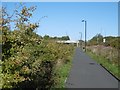
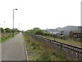
Daily life in NE29 7SP is shaped by its proximity to a range of amenities. Retail options include major stores like Tesco North, M&S Silverlink, and Iceland North, ensuring convenience for shopping and daily essentials. The area’s transport links to metro, rail, and ferry services facilitate access to broader leisure and employment opportunities. While parks and green spaces are not explicitly listed in the data, the absence of environmental constraints like AONB or protected woodlands may indicate more open, residential land use. The presence of multiple transport hubs and retail outlets suggests a community focused on practicality and accessibility. Residents can enjoy a mix of local shopping, efficient travel, and connections to nearby cities, though the small postcode size may limit the variety of on-site leisure facilities.
Amenities
Schools
Residents of NE29 7SP have access to two primary schools with Ofsted ratings of ‘good’: Collingwood Primary School and Norham High School. Both institutions cater to younger students, providing a foundation for early education. The presence of two primary schools within practical reach suggests a focus on family-friendly living, though no secondary schools are listed in the data. This could mean that students require transportation to nearby areas for secondary education. The ‘good’ Ofsted ratings indicate that both schools meet national standards in teaching quality and student outcomes. For families prioritising education, the availability of well-rated primary schools is a significant advantage. However, the absence of secondary schools in the immediate vicinity may require careful planning for long-term schooling needs.
| Rank | School | Type | Entry gender | Ages |
|---|
Explore more schools in this area
Go to Schools tabDemographics
The population of NE29 7SP is predominantly middle-aged, with a median age of 47 and the largest age group being adults aged 30–64. This suggests a community of established professionals and families, likely with long-term ties to the area. Home ownership stands at 52%, indicating a mix of owner-occupied properties and rental units. The accommodation type is primarily houses, which is unusual for a postcode of this size but may reflect a focus on single-family homes. The predominant ethnic group is White, though no data is provided on other demographics. The relatively low population density of 1030 people per square kilometre implies a more spread-out residential layout, which could contribute to a quieter, less congested environment. However, the lack of specific data on deprivation or diversity means the area’s social dynamics remain partially unexplored. For buyers, the demographic profile suggests a stable, mature community with a focus on long-term living rather than transient populations.
Household Size
Accommodation Type
Tenure
Ethnic Group
Religion
Household Composition
Age
Household Deprivation
NS-SEC
Explore more demographic insights in this area
Go to Demographics tabPlanning
Planning Constraints
- Flood RiskPremium
- Ramsar Wetland SitesPremium
- Area of Outstanding Natural BeautyPremium
- Protected Nature ReservePremium
- Protected WoodlandPremium