Area Overview for NE29 7SD
Photos of NE29 7SD


Area Information
NE29 7SD is a small residential postcode in England, home to 1,431 people spread across a densely populated area. The community is compact, with a population density of 1,030 people per square kilometre, reflecting a tight-knit cluster of homes. This area is defined by its proximity to key transport links and local amenities, making it accessible for those needing to commute or access services. Daily life here is shaped by the balance between residential living and nearby infrastructure. The area’s character is influenced by its mix of retail, transport, and educational facilities, which cater to both everyday needs and broader connectivity. With a median age of 47, the population skews towards adults in their 30s to 60s, suggesting a stable, established community. The presence of two well-regarded schools and multiple transport options reinforces its appeal for families and professionals seeking convenience without sacrificing a sense of place.
- Area Type
- Postcode
- Area Size
- Not available
- Population
- 1431
- Population Density
- 1030 people/km²
The property market in NE29 7SD is dominated by owner-occupied homes, with 52% of residents owning their properties. This suggests a relatively stable market where long-term residency is common. The accommodation type is primarily houses, which are likely to be family-sized properties given the area’s demographic profile. This mix of owner-occupied homes and a focus on houses indicates a community that values private, spacious living rather than rental or shared housing. For buyers, this means the area may have limited availability of flats or smaller units, and competition for homes could be higher due to the small postcode size. The proximity to schools, transport, and amenities further enhances the appeal of property ownership here, though buyers should consider the high crime risk when assessing overall value.
House Prices in NE29 7SD
No properties found in this postcode.
Energy Efficiency in NE29 7SD
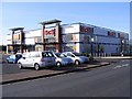
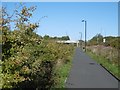
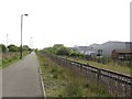
Daily life in NE29 7SD is supported by a range of nearby amenities. Retail options include Tesco North, M&S Silverlink, and Iceland North, offering everything from groceries to household essentials. The area’s proximity to rail, metro, and ferry services, including Howdon and Newcastle International Ferry Terminal, ensures easy access to regional destinations. Parks and open spaces are not explicitly listed, but the absence of protected natural areas suggests a focus on urban convenience. The variety of transport links and retail choices enhances the area’s appeal, providing both practicality and accessibility. Residents can enjoy a mix of shopping, travel, and local services without needing to travel far, contributing to a balanced lifestyle.
Amenities
Schools
Residents of NE29 7SD have access to two schools within practical reach: Collingwood Primary School and Norham High School, both rated ‘good’ by Ofsted. These institutions cater to primary and secondary education, providing a seamless transition for families. The presence of both a primary and a high school in the immediate vicinity reduces the need for long commutes, which is a significant advantage for parents. The ‘good’ Ofsted ratings suggest that the schools meet or exceed national standards in teaching quality, resources, and student outcomes. This combination of school types supports a comprehensive educational pathway, making the area attractive for families prioritising convenience and academic quality.
| Rank | School | Type | Entry gender | Ages |
|---|
Explore more schools in this area
Go to Schools tabDemographics
The population of NE29 7SD is predominantly adults aged 30–64, with a median age of 47. This suggests a mature, settled community with a focus on family living and long-term residency. Home ownership is strong, with 52% of residents owning their homes, indicating a stable housing market. The area is characterised by a high proportion of houses, which aligns with the typical housing stock in such postcode clusters. The predominant ethnic group is White, reflecting the broader demographic trends in the region. While no specific data on deprivation is provided, the high home ownership rate and access to amenities suggest a generally stable quality of life. However, the high crime risk score of 19/100, described as critical, raises practical concerns for residents about safety and security. This figure places the area above average in crime rates, which may influence decisions about living here.
Household Size
Accommodation Type
Tenure
Ethnic Group
Religion
Household Composition
Age
Household Deprivation
NS-SEC
Explore more demographic insights in this area
Go to Demographics tabPlanning
Planning Constraints
- Flood RiskPremium
- Ramsar Wetland SitesPremium
- Area of Outstanding Natural BeautyPremium
- Protected Nature ReservePremium
- Protected WoodlandPremium