Area Overview for NE29 6TD
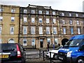
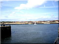
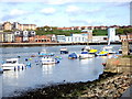
Photos of NE29 6TD


Area Information
NE29 6TD is a small, tightly knit residential postcode area in England, home to 1,551 people spread across a compact cluster of properties. With a population density of 1,144 people per square kilometre, it reflects a mix of established housing and community life. The area’s character is shaped by its proximity to transport links and local amenities, making it practical for daily living. Residents here are predominantly adults aged 30–64, with a median age of 47, suggesting a mature, stable population. While the area is not large, its density supports a sense of familiarity, with homes primarily occupied by owners rather than renters. Living in NE29 6TD means navigating a balance between residential tranquillity and access to nearby services, from retail hubs to public transport. The postcode’s small size means its immediate surroundings are key to understanding its appeal, with nearby towns and cities offering broader opportunities. For those considering homes in NE29 6TD, the area’s compact nature and established community make it a viable choice for those prioritising convenience and connectivity.
- Area Type
- Postcode
- Area Size
- Not available
- Population
- 1551
- Population Density
- 1144 people/km²
The property market in NE29 6TD is characterised by a high rate of home ownership—66% of residents own their homes—suggesting a community that values stability and long-term investment. The predominant accommodation type is houses, which contrasts with areas where flats or apartments are more common. This indicates a housing stock that may appeal to families or those seeking more space. Given the small size of the postcode, the immediate surrounding areas are likely to offer similar property types, though buyers should consider the limited scale of the area when exploring options. The high home ownership rate also implies that rental availability may be constrained, making it a less dynamic market for tenants. For those seeking homes in NE29 6TD, the focus on owner-occupied properties suggests a neighbourhood where property values may be influenced by local demand and proximity to amenities.
House Prices in NE29 6TD
No properties found in this postcode.
Energy Efficiency in NE29 6TD
Living in NE29 6TD grants access to a range of amenities within practical reach. The area’s retail options include Heron Market, Asda South, and Asda North, offering everyday shopping needs. For transport, residents can utilise ferry services at South Shields Ferry Terminal and Newcastle International Ferry Terminal, alongside five metro stations and five rail stations, such as Brockley Whins Railway Station. These connections facilitate travel to nearby towns and cities. The presence of multiple retail outlets and transport hubs suggests a lifestyle that balances convenience with accessibility. While the area itself is small, its proximity to larger centres means residents can enjoy a broader range of leisure and cultural activities beyond its immediate boundaries. The combination of local shops, transport links, and nearby services creates a functional, practical environment for daily life.
Amenities
Schools
| Rank | School | Type | Entry gender | Ages |
|---|
Explore more schools in this area
Go to Schools tabDemographics
The community in NE29 6TD is predominantly composed of adults aged 30–64, with a median age of 47. This suggests a population that is largely in their prime working years, with families and professionals forming the core of the area. Home ownership is high, at 66%, indicating a stable, long-term resident base. The accommodation types here are primarily houses, which contrasts with areas where flats or apartments dominate. The predominant ethnic group is White, reflecting a homogenous demographic profile. While no specific data on deprivation is provided, the high home ownership rate and age distribution suggest a community with relatively stable economic conditions. However, the absence of detailed diversity metrics means the area’s cultural composition remains less defined. For buyers, this profile implies a neighbourhood that is likely to retain its character over time, with residents prioritising settled, family-oriented living.
Household Size
Accommodation Type
Tenure
Ethnic Group
Religion
Household Composition
Age
Household Deprivation
NS-SEC
Explore more demographic insights in this area
Go to Demographics tabPlanning
Planning Constraints
- Flood RiskPremium
- Ramsar Wetland SitesPremium
- Area of Outstanding Natural BeautyPremium
- Protected Nature ReservePremium
- Protected WoodlandPremium
- Crime & SafetyPremium