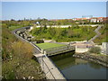
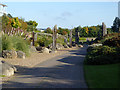
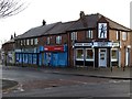
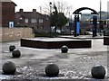
Area Overview for NE29 6PW
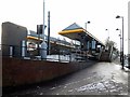
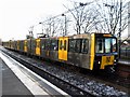
Photos of NE29 6PW


Area Information
Living in NE29 6PW offers a distinct experience within a small residential cluster covering just 3,978 square metres. This specific postcode area houses a population of 1,499 people, resulting in a population density of 376,807 people per square kilometre. This high density indicates a compact living environment typical of specific urban or town centre clusters. The area is entirely dedicated to housing, creating a focused community slate without large commercial or industrial buffers directly within these boundaries. Residents here live in close proximity to their neighbours, which fosters a tight-knit social fabric but also compresses the immediate outdoor space available to each household. Daily life in this postcode is defined by convenience, yet the sheer density suggests a need for efficient local planning to manage movement and noise. The area serves as a small, defined pocket within the wider North East landscape where every resident feels part of a smaller, more concentrated community.
- Area Type
- Postcode
- Area Size
- 3978 m²
- Population
- Not available
- Population Density
- Not available
Homes in NE29 6PW consist primarily of houses, as indicated by the accommodation type data. This housing stock differs from high-density apartment blocks common in city centres, suggesting residents value ground-floor access and private gardens where possible. However, with only 37% home ownership, the market is heavily weighted towards rental properties. This dynamic means you are likely to see more listings from landlords or agencies rather than seller-owned homes. The small area size of 3,978 square metres confirms that these homes are clustered tightly together. For buyers looking at this specific postcode, the primary focus should be on the condition of individual tenanted houses and the potential for rental Income or outright purchase in a tight market. The low ownership rate implies high liquidity for rentals but potentially less stable value appreciation compared to high-homeownership districts.
House Prices in NE29 6PW
Showing 12 properties
Energy Efficiency in NE29 6PW
Residents of NE29 6PW enjoy strong connectivity to essential amenities within easy reach. A rail network places Brockley Whins Railway Station, Railway Station, and East Boldon Railway Station nearby, offering multiple transport options. For travel by sea, two ferry terminals including Newcastle International Ferry Terminal and South Shields Ferry Terminal are accessible in the wider network. Local metro hubs at Percy Main, Meadow Well, and Howdon serve as key interchange points. Grocery shopping is convenient with a Spar located close by, alongside Aldi Hawkeys and Aldi Howdon, ensuring residents have multiple choices for fresh food and household goods. A single bus stop at Rhodes Street provides additional local transport links. This network means you can easily access Newcastle or the coast without travelling far. The variety of retail and transport nodes ensures daily errands are completed efficiently.
Amenities
Schools
Families living in NE29 6PW have access to three prominent educational institutions. North Shields Nursery School caters to the youngest learners before they start formal education. For primary education, parents can choose between Riverside Primary School and Percy St John's CofE Aided Primary School. Riverside Primary School holds an Ofsted rating of satisfactory, indicating it meets the government's minimum standards for education quality. Percy St John's CofE Aided Primary School also serves the local children. This mix provides options for both maintained and voluntary-aided faith schools close to the cluster. The presence of a nursery alongside primary schools suggests the area appeals to young families, despite the high population density and adult median age. All these institutions are within practical reach for residents of the 1,499-person community.
| Rank | School | Type | Entry gender | Ages |
|---|
Explore more schools in this area
Go to Schools tabDemographics
The community in NE29 6PW is dominated by adults aged between 30 and 64 years. The median age for residents is 47, pointing towards a population where families with children and young professionals coexist alongside older adults. This age profile suggests a stable neighbourhood where long-term residents tend to stay. Homeownership stands at 37%, meaning the majority of residents live in rented accommodation. Consequently, the area feels more transient than owner-occupied suburbs, though the presence of houses indicates these tenanted homes are likely substantial properties rather than student flats. The predominant ethnic group is White, reflecting the broader demographic makeup of the region. These figures paint a picture of a mature community where the primary occupants are working adults managing households within a house-dominated stock.
Household Size
Accommodation Type
Tenure
Ethnic Group
Religion
Household Composition
Age
Household Deprivation
NS-SEC
Explore more demographic insights in this area
Go to Demographics tabPlanning
Planning Constraints
- Flood RiskPremium
- Ramsar Wetland SitesPremium
- Area of Outstanding Natural BeautyPremium
- Protected Nature ReservePremium
- Protected WoodlandPremium