Area Overview for NE29 6EG
Photos of NE29 6EG


Area Information
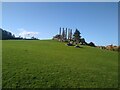
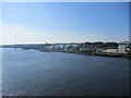
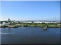
Living in NE29 6EG means being part of a tightly knit residential cluster in northeast England, where 1,551 people reside across a compact area with a population density of 1,144 people per square kilometre. This postcode is characterised by a mix of established housing and proximity to transport hubs, making it a practical choice for those seeking connectivity without urban congestion. The area’s small footprint means it is likely to be surrounded by similar residential clusters, creating a sense of familiarity for new residents. Daily life here is shaped by its location near major transport arteries, including ferries and rail links, which provide easy access to Newcastle and surrounding towns. The presence of multiple retail spots and public transport options ensures that essential services are within reach, while the demographic profile—skewed towards adults aged 30–64—suggests a community rooted in stability and routine. For buyers, this area offers a balance of residential comfort and functional access to broader networks, though its size means the character of the neighbourhood is defined by its immediate surroundings.
- Area Type
- Postcode
- Area Size
- Not available
- Population
- 1551
- Population Density
- 1144 people/km²
The property market in NE29 6EG is dominated by owner-occupied homes, with 66% of residents living in properties they own. This high level of home ownership indicates a community that prioritises stability and long-term investment. The accommodation type is primarily houses, which suggests a market skewed towards traditional, family-sized homes rather than flats or newer developments. Given the small size of the postcode area, the housing stock is likely limited, meaning buyers may need to consider nearby postcodes for additional options. The prevalence of houses also implies that the area may appeal to those seeking spacious, established properties rather than rental-focused or speculative investment. For buyers, this means a market with fewer turnover opportunities but potentially higher value retention, though proximity to transport links could enhance desirability for commuters or those seeking access to larger cities.
House Prices in NE29 6EG
No properties found in this postcode.
Energy Efficiency in NE29 6EG
Residents of NE29 6EG have access to a range of amenities within practical reach. Retail options include Heron Market, Asda South, and Heron Frederick, offering everything from daily essentials to local shopping experiences. The area’s proximity to ferry terminals and multiple metro and rail stations means residents can easily access larger towns like Newcastle for dining, entertainment, or specialist services. While the data does not specify parks or leisure facilities directly, the presence of transport links suggests nearby green spaces or recreational areas are accessible via short journeys. The variety of transport options and retail hubs contributes to a lifestyle that balances local convenience with broader connectivity, allowing residents to enjoy both the quiet of a small cluster and the vibrancy of larger urban centres.
Amenities
Schools
| Rank | School | Type | Entry gender | Ages |
|---|
Explore more schools in this area
Go to Schools tabDemographics
The community in NE29 6EG is predominantly composed of adults aged 30–64, with a median age of 47. This suggests a mature, established population, likely with strong ties to local institutions and a focus on long-term stability. Home ownership is high, with 66% of residents living in properties they own, reflecting a preference for settled living. The accommodation type is primarily houses, indicating a more traditional housing stock compared to flats or apartments. The predominant ethnic group is White, though the data does not specify further diversity metrics. This demographic profile aligns with a community that values permanence and may have lower turnover rates. The absence of specific deprivation data means no conclusions can be drawn about economic challenges, but the high home ownership and age distribution imply a relatively stable socioeconomic environment. For buyers, this suggests a market where properties are likely to be family-oriented and held for the long term.
Household Size
Accommodation Type
Tenure
Ethnic Group
Religion
Household Composition
Age
Household Deprivation
NS-SEC
Explore more demographic insights in this area
Go to Demographics tabPlanning
Planning Constraints
- Flood RiskPremium
- Ramsar Wetland SitesPremium
- Area of Outstanding Natural BeautyPremium
- Protected Nature ReservePremium
- Protected WoodlandPremium
- Crime & SafetyPremium