Area Overview for NE29 6EB
Photos of NE29 6EB
Area Information
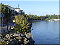
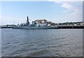
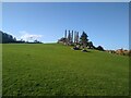
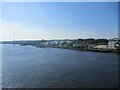
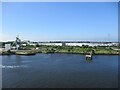
Living in NE29 6EB means being part of a tightly knit residential cluster in northeast England. With a population of 1,551 and a density of 1,144 people per square kilometre, this area is compact yet functional. The community is predominantly composed of adults aged 30–64, reflecting a mature demographic that values stability. The high home ownership rate of 66% suggests a mix of long-term residents and families who have established roots here. Daily life is shaped by proximity to transport networks, with ferries, metro lines, and rail stations within practical reach. The area’s small size means amenities are concentrated, making it convenient for those who prefer accessible services over sprawling suburbs. While it lacks natural or protected landscapes, its strategic location near Newcastle and South Shields offers easy access to urban opportunities. For buyers, NE29 6EB presents a blend of residential tranquillity and connectivity, ideal for those seeking a balance between community and accessibility.
- Area Type
- Postcode
- Area Size
- Not available
- Population
- 1551
- Population Density
- 1144 people/km²
NE29 6EB is a predominantly owner-occupied area, with 66% of residents living in homes they own. The accommodation type is exclusively houses, which contrasts with areas where flats or apartments dominate. This suggests a housing stock tailored to families or individuals seeking more space. The small size of the postcode area means the property market is limited in scale, with fewer options compared to larger urban zones. Buyers should consider that the area’s compact nature may restrict availability, though the focus on houses could appeal to those prioritising private living space. The lack of rental data implies that the market is not heavily driven by tenants, making it a potentially stable environment for homebuyers. However, the limited size of NE29 6EB means prospective buyers may need to look beyond immediate surroundings for additional choices.
House Prices in NE29 6EB
No properties found in this postcode.
Energy Efficiency in NE29 6EB
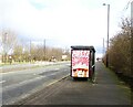
The lifestyle in NE29 6EB is shaped by its proximity to a range of amenities. Retail options include Heron Market, Asda South, and Heron Frederick, offering shopping and dining choices within walking distance. Transport links are extensive, with ferry terminals, metro stations, and rail services providing easy access to Newcastle, South Shields, and surrounding areas. While the area lacks detailed information on parks or leisure facilities, the presence of multiple transport hubs and retail spots suggests a focus on practicality. The variety of transport options, including five metro and rail stations, ensures residents can reach workplaces, schools, and services efficiently. The compact nature of the area means daily errands are manageable without long journeys, contributing to a convenient, accessible lifestyle.
Amenities
Schools
| Rank | School | Type | Entry gender | Ages |
|---|
Explore more schools in this area
Go to Schools tabDemographics
The population of NE29 6EB is predominantly adults aged 30–64, with a median age of 47. This suggests a community of established professionals and families, rather than students or retirees. Home ownership is strong, with 66% of residents owning their homes, indicating a stable housing market. The area is characterised by houses rather than flats, reflecting a traditional residential layout. The predominant ethnic group is White, though no specific data on diversity or deprivation is provided. The age profile implies a mature demographic, which may influence local services and amenities. With no mention of younger or older populations, the area appears to cater to middle-aged households. The absence of detailed diversity metrics means the community’s full composition remains unclear, but the data highlights a focus on stability and long-term residency.
Household Size
Accommodation Type
Tenure
Ethnic Group
Religion
Household Composition
Age
Household Deprivation
NS-SEC
Explore more demographic insights in this area
Go to Demographics tabPlanning
Planning Constraints
- Flood RiskPremium
- Ramsar Wetland SitesPremium
- Area of Outstanding Natural BeautyPremium
- Protected Nature ReservePremium
- Protected WoodlandPremium
- Crime & SafetyPremium