Area Overview for NE29 0YH
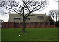
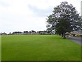
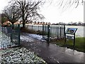
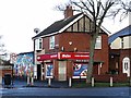
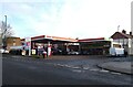
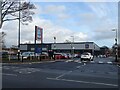
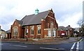
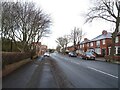
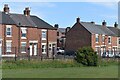
Photos of NE29 0YH
Area Information
NE29 0YH is a small, tightly knit residential postcode in England, home to 1,534 residents. This area is characterised by its compact size and proximity to essential services, making it ideal for those seeking a balance between suburban tranquillity and urban convenience. The population is predominantly adults aged 30–64, with a median age of 47, suggesting a community of established professionals and families. Daily life here is shaped by the area’s connectivity to transport networks, including rail, metro, and ferry services, which provide easy access to nearby towns and cities. The absence of significant environmental constraints, such as flood zones or protected natural sites, adds to its appeal. Residents benefit from excellent broadband connectivity, rated at 100 out of 100, ensuring seamless digital experiences. While the area is small, it is well-served by retail options, including Aldi Hawkeys and Co-op North Shields, and multiple transport hubs, such as North Shields and Meadow Well metro stations. This postcode is suited to those prioritising safety, accessibility, and a stable, community-focused lifestyle.
- Area Type
- Postcode
- Area Size
- Not available
- Population
- 1534
- Population Density
- Not available
The property market in NE29 0YH is dominated by owner-occupied homes, with 72% of residents living in properties they own. This high home ownership rate suggests a stable and established community, with limited rental activity. The accommodation type is primarily houses, which contrasts with areas where flats or apartments predominate. This indicates a preference for standalone homes, possibly appealing to families or those seeking more space. Given the area’s small size, the housing stock is likely limited, making it a niche market for buyers seeking a specific postcode. The proximity to transport links, including rail and metro stations, may enhance the area’s appeal, particularly for commuters. However, buyers should consider the compact nature of the area and its immediate surroundings, as property options may be constrained by the postcode’s boundaries.
House Prices in NE29 0YH
No properties found in this postcode.
Energy Efficiency in NE29 0YH
Living in NE29 0YH offers access to a range of amenities within practical reach. Retail options include Aldi Hawkeys, Co-op North Shields, and Heron Preston, ensuring everyday shopping needs are met. The area’s transport links are extensive, with metro stations at North Shields, Meadow Well, and Percy Main, and rail services at multiple stops, including Brockley Whins Railway Station. Ferry terminals at South Shields and Newcastle International provide additional mobility, particularly for those working or traveling across the water. A bus route at Rhodes Street adds to the connectivity. While the area is small, its proximity to these services creates a convenient lifestyle, blending suburban comfort with urban accessibility. The presence of multiple transport hubs and retail outlets suggests a community prioritising practicality and ease of movement.
Amenities
Schools
| Rank | School | Type | Entry gender | Ages |
|---|
Explore more schools in this area
Go to Schools tabDemographics
The population of NE29 0YH is predominantly adults aged 30–64, with a median age of 47. This suggests a mature, settled community, likely composed of professionals and families. Home ownership is high, with 72% of residents owning their homes, indicating a stable housing market. The area is primarily composed of houses, rather than flats or apartments, reflecting a preference for standalone properties. The predominant ethnic group is White, though specific data on diversity or deprivation is not provided. The low crime risk score of 69/100, combined with no flood risk or environmental constraints, implies a safe and secure living environment. The demographic profile suggests a community focused on long-term residency, with limited turnover, which can contribute to a strong sense of local identity and neighbourly connections.
Household Size
Accommodation Type
Tenure
Ethnic Group
Religion
Household Composition
Age
Household Deprivation
NS-SEC
Explore more demographic insights in this area
Go to Demographics tabPlanning
Planning Constraints
- Flood RiskPremium
- Ramsar Wetland SitesPremium
- Area of Outstanding Natural BeautyPremium
- Protected Nature ReservePremium
- Protected WoodlandPremium
- Crime & SafetyPremium