Area Overview for NE28 9ZB
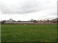
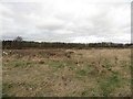
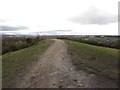
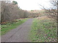
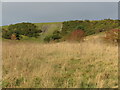
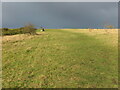
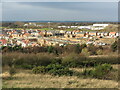
Photos of NE28 9ZB
Area Information
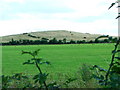
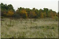
Living in NE28 9ZB offers a quiet, residential experience within a small cluster of homes. With a population of 2,542, the area is compact yet well-served by transport links and amenities. The community is predominantly made up of adults aged 30–64, reflecting a mature demographic. Daily life here is shaped by proximity to metro stations such as Benton and Palmersville, alongside retail options like Asda Benton and Tesco Battle. The area’s low crime risk and absence of environmental constraints like protected woodlands or wetlands make it appealing for families and professionals seeking stability. While it lacks large-scale leisure facilities, its practical connectivity to rail, ferry, and airport services ensures easy access to Newcastle and beyond. The high broadband score of 99 and good mobile coverage support remote work and digital lifestyles, aligning with modern needs. NE28 9ZB is a blend of simplicity and accessibility, ideal for those prioritising safety, convenience, and a manageable community environment.
- Area Type
- Postcode
- Area Size
- Not available
- Population
- 2542
- Population Density
- 4673 people/km²
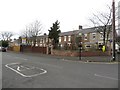
NE28 9ZB is primarily an owner-occupied area, with 81% of homes owned by residents rather than rented. The housing stock consists almost entirely of houses, not flats or apartments, which is uncommon in many urban areas. This suggests a market skewed towards family homes and long-term investors, with limited rental activity. The small size of the postcode means the property landscape is tightly concentrated, with few new developments likely. Buyers should expect a stable market with little fluctuation, as the high home ownership rate indicates low demand for rental properties. The absence of large-scale housing projects or student accommodation further reinforces this. For those seeking a home in NE28 9ZB, the focus is on established properties with potential for equity growth, rather than speculative investment.
House Prices in NE28 9ZB
No properties found in this postcode.
Energy Efficiency in NE28 9ZB
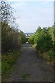
Residents of NE28 9ZB have access to a range of amenities within practical reach. Retail options include Asda Benton, Lidl Hadrian Park, and Tesco Battle, providing everyday shopping convenience. The metro stations at Benton, Palmersville, and Four Lane Ends facilitate quick travel to nearby hubs, while rail services at Manors and Heworth connect to broader regional networks. Ferry terminals at Newcastle International and South Shields offer alternative routes, and Newcastle Airport is a short journey away. Though the area lacks large parks or leisure venues, the presence of multiple transport nodes and retail outlets ensures a functional, accessible lifestyle. The combination of retail, transport, and connectivity makes NE28 9ZB suitable for those prioritising practicality over sprawling leisure facilities.
Amenities
Schools
| Rank | School | Type | Entry gender | Ages |
|---|
Explore more schools in this area
Go to Schools tabDemographics
NE28 9ZB’s population is predominantly adults aged 30–64, with a median age of 47. This suggests a community of established professionals and families, rather than students or retirees. Home ownership is high at 81%, indicating a stable, long-term resident base. The area is composed mainly of houses, not flats, which aligns with the demographic’s preference for private, spacious living. The predominant ethnic group is White, though no specific diversity metrics are provided. The absence of data on deprivation or income levels means this section focuses solely on the available statistics. The age profile and ownership rates suggest a low turnover of properties, with residents likely to have built equity over time. This demographic profile shapes a community characterised by continuity and a focus on long-term residency.
Household Size
Accommodation Type
Tenure
Ethnic Group
Religion
Household Composition
Age
Household Deprivation
NS-SEC
Explore more demographic insights in this area
Go to Demographics tabPlanning
Planning Constraints
- Flood RiskPremium
- Ramsar Wetland SitesPremium
- Area of Outstanding Natural BeautyPremium
- Protected Nature ReservePremium
- Protected WoodlandPremium