Area Overview for NE28 9WW
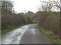
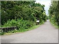
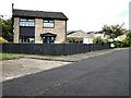
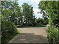
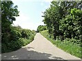
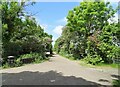
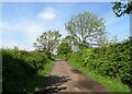
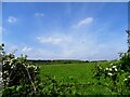
Photos of NE28 9WW
Area Information
Living in NE28 9WW offers a quiet, residential experience within a small cluster of homes. With a population of 1,359, this area is characterised by a mature community, where the median age of 47 suggests a stable demographic. The postcode covers a compact residential zone, primarily occupied by homeowners, with 76% of properties owned by residents. This makes it a place where long-term living is common, and the housing stock is predominantly houses rather than flats. The area’s proximity to multiple schools, retail outlets, and transport links adds to its practical appeal. While it lacks natural beauty designations or protected sites, it benefits from low flood risk and a safety score of 77, indicating a secure environment. For those seeking a low-maintenance lifestyle with access to essential services, NE28 9WW provides a straightforward, community-focused setting. Its small size means amenities are concentrated, making daily life efficient but potentially limiting in terms of variety.
- Area Type
- Postcode
- Area Size
- Not available
- Population
- 1359
- Population Density
- 4850 people/km²
The property market in NE28 9WW is dominated by owner-occupied homes, with 76% of properties owned by residents. This high ownership rate suggests a community of long-term residents, with limited rental activity. The accommodation type is predominantly houses, which are more common than flats or apartments in this area. For buyers, this means a focus on family homes or larger properties, rather than modern apartments. The small size of the postcode area means the housing stock is limited, but the presence of multiple schools and transport links may make it attractive for those prioritising convenience over choice. The market is likely to be stable, with fewer speculative investments, and properties may retain value due to the area’s low risk of environmental hazards. However, the lack of new developments could limit future growth in property options.
House Prices in NE28 9WW
No properties found in this postcode.
Energy Efficiency in NE28 9WW
Daily life in NE28 9WW is shaped by its proximity to retail, transport, and leisure options. The area’s retail landscape includes major supermarkets like Tesco and Lidl, ensuring easy access to groceries and everyday essentials. Metro stations at Palmersville and Northumberland Park provide links to nearby urban centres, while rail services at Railway Station and Manors Railway Station connect to broader networks. A bus route at Rhodes Street offers local travel, and ferry terminals at Newcastle and South Shields enable trips to coastal or city destinations. Parks and open spaces are not explicitly mentioned in the data, but the absence of protected natural areas suggests a focus on practical, urban amenities. The combination of retail, transport, and ferry access creates a convenient lifestyle, though the small area size may limit options for those seeking diverse leisure activities.
Amenities
Schools
NE28 9WW is served by several primary schools, including Hadrian Park First School, Hadrian Park Middle School, and Hadrian Park Primary School, which cater to younger children. Additional educational services are provided by the Accelerated Learning Service and Primary Resource Provision, which may offer specialist or alternative education. The concentration of primary schools suggests a family-friendly environment, though the absence of secondary schools means students may need to travel to nearby areas for higher education. The mix of school types could indicate a range of educational approaches, but without Ofsted ratings or specific performance data, it is unclear how these institutions compare nationally. For parents, the proximity of multiple schools reduces the need for long commutes, but the lack of secondary options should be considered when planning a family’s long-term needs.
| Rank | School | Type | Entry gender | Ages |
|---|
Explore more schools in this area
Go to Schools tabDemographics
The community in NE28 9WW is predominantly composed of adults aged 30–64, reflecting a mature population with a median age of 47. Home ownership is high, at 76%, suggesting a stable, long-term resident base. The area is largely occupied by houses, which aligns with the demographic profile of established families. The predominant ethnic group is White, with no specific data on other groups provided. While the data does not include deprivation metrics, the high home ownership rate and low crime risk imply a relatively affluent and secure environment. This stability may contribute to a sense of community cohesion, though the lack of diversity data means the full picture of social dynamics remains unclear. The age range indicates a population that is likely retired or in later career stages, which could influence local services and amenities.
Household Size
Accommodation Type
Tenure
Ethnic Group
Religion
Household Composition
Age
Household Deprivation
NS-SEC
Explore more demographic insights in this area
Go to Demographics tabPlanning
Planning Constraints
- Flood RiskPremium
- Ramsar Wetland SitesPremium
- Area of Outstanding Natural BeautyPremium
- Protected Nature ReservePremium
- Protected WoodlandPremium