Area Overview for NE28 9NH
Photos of NE28 9NH


Area Information
NE28 9NH is a small residential cluster in England, home to 1,607 residents. This area is defined by its compact size and proximity to essential services, making it a practical choice for those seeking a balance between urban convenience and a quieter lifestyle. The community is predominantly composed of adults aged 30–64, reflecting a mature demographic with established routines. Daily life here is shaped by the availability of nearby amenities, including retail outlets, rail links, and schools. The area’s low flood risk and absence of protected natural sites mean residents face minimal environmental constraints. Connectivity is strong, with broadband scoring 100 (excellent) and mobile coverage at 85 (good). While crime rates are average, standard precautions are advisable. NE28 9NH is ideal for families and professionals who value accessibility to transport networks and a mix of local services without the pressures of larger urban centres.
- Area Type
- Postcode
- Area Size
- Not available
- Population
- 1607
- Population Density
- 4685 people/km²
NE28 9NH is a small area with a housing stock predominantly composed of houses, rather than flats or apartments. With a home ownership rate of 35%, the market is not heavily skewed toward owner-occupation, suggesting a significant portion of properties may be rented. This dynamic could indicate a mix of long-term residents and transient occupants, though the data does not clarify the proportion of rental properties. The limited size of the area means the housing stock is constrained, potentially leading to competition for available homes. Buyers should consider the small cluster’s proximity to transport links and amenities, which may offset the limited number of properties. The focus on houses may appeal to those seeking more space, but the market’s narrow scope means buyers must act decisively to secure a property in this specific postcode.
House Prices in NE28 9NH
No properties found in this postcode.
Energy Efficiency in NE28 9NH
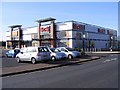
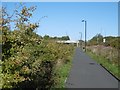
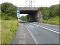
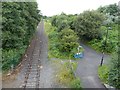
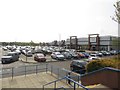
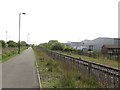
Daily life in NE28 9NH is enriched by a range of nearby amenities, from retail to transport. Retail options include M&S Silverlink, Tesco North, and Iceland North, offering convenience for shopping and daily essentials. The area’s rail stations and metro stops provide access to broader networks, while ferry terminals open up maritime travel possibilities. Though the bus network is limited to Rhodes Street, the density of rail and metro services ensures mobility. The presence of multiple schools and the proximity to transport hubs suggest a community that balances local living with regional connectivity. The mix of retail, transport, and educational facilities creates a functional lifestyle, though the small area size means residents may need to travel for more specialised services.
Amenities
Schools
Residents of NE28 9NH have access to a range of schools, including primary and special education institutions. St Aidan’s Roman Catholic Primary School and St Aidan’s Catholic Primary School, Wallsend serve as primary options, while Churchill Community College and Langdale Community Middle School cater to similar age groups. Silverdale School is a special needs institution, offering tailored support for students with specific requirements. This mix of school types ensures families have choices, whether prioritising religious education, mainstream schooling, or specialist support. The presence of multiple primary schools suggests a strong focus on early education, which is crucial for young families. However, the absence of secondary schools in the immediate area may require commuting, though nearby rail links could ease this challenge.
| Rank | School | Type | Entry gender | Ages |
|---|
Explore more schools in this area
Go to Schools tabDemographics
The population of NE28 9NH is 1,607, with a median age of 47. The most common age group is adults aged 30–64, indicating a community with a strong presence of middle-aged individuals. Home ownership sits at 35%, suggesting a mix of owner-occupied properties and rental units, though the data does not specify the proportion of renters. The area is primarily composed of houses, aligning with the accommodation type listed. The predominant ethnic group is White, though no further breakdown of diversity is provided. The demographic profile reflects a settled, middle-aged population, likely with established careers and family ties. This profile may influence local services and amenities, which are tailored to the needs of adults and families. The absence of specific deprivation data means quality of life factors such as access to healthcare or social services are not quantified here.
Household Size
Accommodation Type
Tenure
Ethnic Group
Religion
Household Composition
Age
Household Deprivation
NS-SEC
Explore more demographic insights in this area
Go to Demographics tabPlanning
Planning Constraints
- Flood RiskPremium
- Ramsar Wetland SitesPremium
- Area of Outstanding Natural BeautyPremium
- Protected Nature ReservePremium
- Protected WoodlandPremium