Area Overview for NE28 8TS
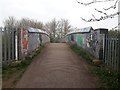
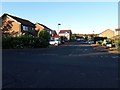
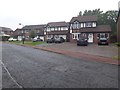
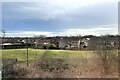
Photos of NE28 8TS
Area Information
NE28 8TS is a compact residential postcode in England, covering 5,392 square metres and home to 1,667 residents. Its high population density of 309,148 people per square kilometre reflects a tightly knit community, likely centred around a small cluster of homes. The area’s proximity to towns like Wallsend and Benton suggests it is part of a broader network of suburban and semi-rural neighbourhoods. Daily life here is shaped by its modest size and the presence of nearby amenities, including retail outlets, transport hubs, and schools. With a median age of 47, the population skews towards adults in their 30s to 60s, indicating a community of established residents. The area’s small footprint means it is likely to be quiet and low-traffic, with homes predominantly owner-occupied. Living here offers a balance of residential tranquillity and access to nearby urban conveniences, though its limited size may mean residents rely on adjacent areas for broader services.
- Area Type
- Postcode
- Area Size
- 5392 m²
- Population
- 1667
- Population Density
- 2074 people/km²
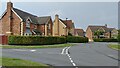
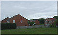
The property market in NE28 8TS is characterised by a high rate of home ownership (61%) and a focus on houses rather than flats or other shared accommodation. This suggests a community prioritising private, long-term residency over rental flexibility. The area’s small size means the housing stock is limited, likely comprising a mix of older properties and newer builds. For buyers, this could present both opportunities and challenges: while the compact nature may reduce competition, the lack of variety in property types could limit options. The dominance of owner-occupied homes also implies that the area is not a hotspot for short-term rentals or speculative investment. Prospective buyers should consider the proximity to nearby towns for additional housing choices, as NE28 8TS itself offers a limited immediate supply.
House Prices in NE28 8TS
Showing 3 properties
| Address | Type | Beds | Baths | Last Sale Price | Last Sale Date | |
|---|---|---|---|---|---|---|
| Good Time Childcare, Nursery At, Redesdale Community Primary School, Wiltshire Drive, Wallsend, NE28 8TS | commercial | - | - | - | - | |
| Playing Field At, Redesdale Community Primary School, Wiltshire Drive, Wallsend, NE28 8TS | Leisure | - | - | - | - | |
| Redesdale Out Of School Club, Redesdale Community Primary School, Wiltshire Drive, Wallsend, NE28 8TS | commercial | - | - | - | - |
Energy Efficiency in NE28 8TS
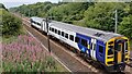
Daily life in NE28 8TS is enriched by nearby amenities, including five retail outlets such as Iceland Wallsend and Aldi High Street West Wallsend. These shops provide convenience for grocery and household needs. The area’s proximity to five metro stations, rail services, and ferry terminals ensures easy access to larger towns and cities, supporting both commuting and leisure travel. Residents can also reach Newcastle Airport with ease, enhancing connectivity for travel. Parks and open spaces are not explicitly listed, but the absence of planning constraints like AONBs or protected woodlands suggests room for local green spaces. The mix of retail, transport, and nearby towns like Benton and Wallsend creates a lifestyle that balances convenience with a sense of community, though the area’s small size means some amenities may require a short trip to adjacent areas.
Amenities
Schools
Nearby schools include Wallsend Jubilee Primary School and Redesdale Primary School, both rated ‘good’ by Ofsted. These institutions provide quality primary education, essential for families with young children. Parkside School, a special school, adds to the diversity of educational options, catering to students with specific needs. The combination of primary and special schools suggests the area is well-suited for families requiring a range of educational provisions. While no secondary schools are listed, the proximity to larger towns like Wallsend likely means additional options are accessible. The ‘good’ Ofsted ratings for the primary schools indicate a strong foundation for early education, though parents may need to look further afield for secondary schooling.
| Rank | School | Type | Entry gender | Ages |
|---|
Explore more schools in this area
Go to Schools tabDemographics
The community in NE28 8TS is predominantly composed of adults aged 30–64, with a median age of 47. This suggests a mature population, likely with long-term ties to the area. Home ownership is high at 61%, indicating stability and a focus on long-term residency rather than rental turnover. The accommodation type is primarily houses, which aligns with the area’s residential character and may contribute to a quieter, more private lifestyle. The predominant ethnic group is White, reflecting the broader demographic patterns of the region. While no specific data on deprivation is provided, the high home ownership rate and age profile suggest a community with established economic foundations. The absence of detailed diversity metrics means the area’s social composition remains largely unexplored in this dataset.
Household Size
Accommodation Type
Tenure
Ethnic Group
Religion
Household Composition
Age
Household Deprivation
NS-SEC
Explore more demographic insights in this area
Go to Demographics tabPlanning
Planning Constraints
- Flood RiskPremium
- Ramsar Wetland SitesPremium
- Area of Outstanding Natural BeautyPremium
- Protected Nature ReservePremium
- Protected WoodlandPremium