Area Overview for NE28 6QS
Photos of NE28 6QS


Area Information
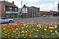
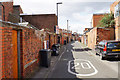
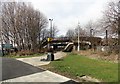
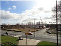
NE28 6QS is a small, tightly knit residential cluster in England, home to 1804 residents. The area’s compact size fosters a close-knit community feel, with daily life centred around local amenities and transport links. The median age of 47 suggests a mature population, with adults aged 30–64 forming the largest demographic group. This reflects a stable, established community, likely with a mix of long-term residents and families. The area’s proximity to transport hubs, including rail stations and ferry terminals, ensures easy access to nearby towns like Newcastle and South Shields. Residents benefit from a blend of practical amenities, from retail outlets like Aldi Howdon to public transport options such as the Rhodes Street bus stop. While the area lacks natural or protected sites, its low flood risk and absence of planning constraints make it a straightforward place to live. For those seeking a quiet, functional neighbourhood with reliable connectivity and transport, NE28 6QS offers a pragmatic choice.
- Area Type
- Postcode
- Area Size
- Not available
- Population
- 1804
- Population Density
- Not available
The property market in NE28 6QS is characterised by a 41% home ownership rate, indicating that less than half of properties are owner-occupied. This suggests a significant portion of the housing stock is rented, potentially attracting a mix of tenants and investors. The accommodation type is predominantly houses, which are more common than flats or apartments in this area. This aligns with the residential nature of NE28 6QS, where single-family homes dominate. For buyers, the small size of the area means the housing stock is limited, and the immediate surroundings may offer more options. However, the lack of specific data on property prices or market trends means prospective buyers should consider nearby postcode areas for a broader range of choices. The focus on houses also implies that the area may cater to families or individuals seeking larger living spaces, though the compact nature of the postcode may restrict availability.
House Prices in NE28 6QS
No properties found in this postcode.
Energy Efficiency in NE28 6QS
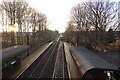
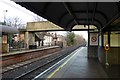
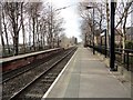
The lifestyle in NE28 6QS is shaped by its practical amenities and transport links. Residents can access five retail outlets, including Heron Howdon and Aldi Howdon, for everyday shopping. The area’s five metro stops, such as Hadrian Road and Jarrow, suggest a network of local services, though specifics are not detailed. For leisure, the presence of ferry terminals at Newcastle and South Shields opens access to coastal and river-based activities. Rail stations like Brockley Whins and Heworth provide commuting options to nearby towns. The lack of parks or recreational spaces is notable, but the area’s compact size means residents can easily reach larger centres for leisure. The mix of retail, transport, and ferry access creates a functional, if modest, lifestyle. The community’s character is defined by its reliance on nearby hubs, with daily life revolving around local shops, transport, and the broader regional network.
Amenities
Schools
Residents of NE28 6QS have access to two primary schools: Wallsend St Peter’s CofE Aided Primary School and St Peter’s Church of England Primary School. Both institutions serve the local community, providing education for younger children. The presence of two primary schools suggests a focus on early education, though no secondary schools are listed in the data. For families with children, this means the area is well-served for primary schooling, but parents may need to look further afield for secondary education. The schools’ types—both Church of England-affiliated—indicate a religious or community-oriented approach to education. However, without specific Ofsted ratings or performance data, it is unclear how these schools compare to others in the region. Nonetheless, the availability of two primary schools supports the area’s appeal to families seeking local childcare options.
| Rank | School | Type | Entry gender | Ages |
|---|
Explore more schools in this area
Go to Schools tabDemographics
The population of NE28 6QS is predominantly adults aged 30–64, with a median age of 47. This suggests a community of middle-aged individuals, many of whom may be in their prime working years or raising families. Home ownership stands at 41%, indicating a mix of owner-occupied properties and rental units. The accommodation type is largely houses, reflecting a residential area with single-family homes rather than apartments or flats. The predominant ethnic group is White, though no further breakdown of diversity is provided. The absence of specific data on deprivation or income levels means the area’s economic profile remains unclear. However, the age profile and housing stock suggest a relatively stable, low-turnover community. For families, the presence of two primary schools nearby may support local childcare needs, though broader educational options are limited to primary levels.
Household Size
Accommodation Type
Tenure
Ethnic Group
Religion
Household Composition
Age
Household Deprivation
NS-SEC
Explore more demographic insights in this area
Go to Demographics tabPlanning
Planning Constraints
- Flood RiskPremium
- Ramsar Wetland SitesPremium
- Area of Outstanding Natural BeautyPremium
- Protected Nature ReservePremium
- Protected WoodlandPremium
- Crime & SafetyPremium