Area Overview for NE28 6QN
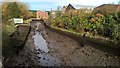
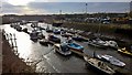
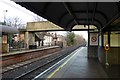
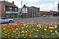
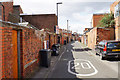
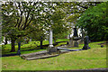
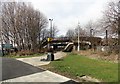
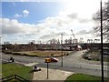
Photos of NE28 6QN


Area Information
NE28 6QN is a small, tightly knit residential postcode in England, home to 1,804 residents. Its compact size fosters a quiet, community-focused atmosphere, typical of smaller clusters where neighbours often know one another. The area’s demographic profile suggests a mature population, with a median age of 47 and the majority of residents falling within the 30–64 age range. This hints at a stable, established community, likely with long-standing family ties. Living here means proximity to essential services, with five nearby railway stations and multiple retail outlets within practical reach. The area’s small footprint means it’s not sprawling, but it offers a balance of residential calm and access to transport networks. For those prioritising convenience, the postcode’s proximity to ferry terminals and motorway links ensures connectivity to larger cities like Newcastle and South Shields. While it lacks the vibrancy of urban centres, its low flood risk and absence of environmental constraints make it a practical choice for buyers seeking a steady, predictable lifestyle.
- Area Type
- Postcode
- Area Size
- Not available
- Population
- 1804
- Population Density
- Not available
The property market in NE28 6QN is characterised by a 41% home ownership rate, with houses being the predominant type of accommodation. This suggests a market skewed towards owner-occupation rather than rental properties, though the relatively low home ownership figure indicates a significant portion of the housing stock is likely rented out. The presence of houses, rather than flats or apartments, implies a more traditional, low-density residential layout. For buyers, this means a focus on individual properties rather than shared spaces, which may appeal to those prioritising privacy and space. Given the area’s small size, property availability is likely limited, and the market may be competitive for those seeking specific features. The absence of high-end developments or luxury housing suggests a practical, no-frills approach to property in this postcode. Buyers should consider the balance between ownership rates and local demand, as well as the potential for long-term stability in a community with a mature demographic profile.
House Prices in NE28 6QN
No properties found in this postcode.
Energy Efficiency in NE28 6QN
Daily life in NE28 6QN is shaped by its proximity to a range of amenities, from retail to transport. Five retail outlets, including Aldi Howdon and Iceland Jarrow, provide essential shopping options, while five metro stations and five railway stations ensure easy access to urban centres. The area’s ferry terminals connect residents to Newcastle and South Shields, offering both leisure and commuting opportunities. For leisure, the nearby metro stations at Howdon and Jarrow may provide access to local parks or cultural sites, though specific names are not listed. The presence of multiple transport options and retail hubs suggests a practical, convenience-driven lifestyle. While the area lacks high-end dining or entertainment venues, its infrastructure supports a straightforward, functional approach to daily living. The combination of transport links and retail access makes NE28 6QN suitable for those prioritising efficiency over luxury.
Amenities
Schools
Residents of NE28 6QN have access to two primary schools within practical reach: Wallsend St Peter’s CofE Aided Primary School and St Peter’s Church of England Primary School. Both are state-funded institutions, providing a range of educational options for young families. The presence of two primary schools in close proximity suggests a focus on local education, reducing the need for long commutes. However, no data on Ofsted ratings or academic performance is available, so prospective parents may need to conduct further research into the quality of education. The schools’ names and types indicate a mix of faith-based and secular education, offering families choices aligned with their preferences. For those prioritising proximity to schools, this area provides a solid foundation, though additional information on secondary education options or specialist provision would be necessary for a complete picture.
| Rank | School | Type | Entry gender | Ages |
|---|
Explore more schools in this area
Go to Schools tabDemographics
The population of NE28 6QN is predominantly composed of adults aged 30–64, with a median age of 47. This suggests a community of middle-aged residents, many of whom may be in their peak earning years or nearing retirement. Home ownership in the area stands at 41%, indicating a mix of owner-occupied properties and rental units. The accommodation type is primarily houses, which is notable in a region where flats or terraced housing might be more common. The predominant ethnic group is White, reflecting broader trends in the region. While no specific data on deprivation is provided, the age profile and home ownership rate suggest a relatively stable socioeconomic environment. However, the lack of detailed diversity metrics means the community’s full demographic composition remains partially unexplored. The absence of younger families or students could influence local amenities and service provision, though the presence of two primary schools nearby hints at a focus on family needs.
Household Size
Accommodation Type
Tenure
Ethnic Group
Religion
Household Composition
Age
Household Deprivation
NS-SEC
Explore more demographic insights in this area
Go to Demographics tabPlanning
Planning Constraints
- Flood RiskPremium
- Ramsar Wetland SitesPremium
- Area of Outstanding Natural BeautyPremium
- Protected Nature ReservePremium
- Protected WoodlandPremium
- Crime & SafetyPremium