Area Overview for NE28 6NT
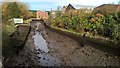
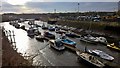
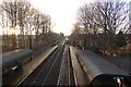
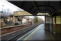
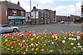
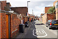
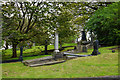
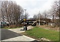
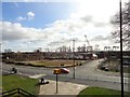
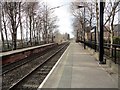
Photos of NE28 6NT


Area Information
NE28 6NT is a small residential postcode area in England, home to around 1800 people. This compact cluster of homes sits in a neighbourhood where the median age is 47, with the majority of residents falling between 30 and 64 years old. The area is predominantly composed of houses, reflecting a more traditional housing stock. While it lacks the density of larger urban centres, it offers a quiet, community-focused environment. Nearby, residents have access to primary schools such as Wallsend St Peter’s CofE Aided Primary School and St Peter’s Church of England Primary School, ensuring local educational provision. The area’s proximity to transport networks, including rail stations and ferry terminals, provides connectivity to nearby towns like Jarrow and South Shields. For those seeking a balance between convenience and tranquillity, NE28 6NT offers a distinct blend of residential stability and practical accessibility.
- Area Type
- Postcode
- Area Size
- Not available
- Population
- 1804
- Population Density
- Not available
NE28 6NT is characterised by a housing stock that is predominantly composed of houses, reflecting a more traditional and less densely populated residential area. With 41% of properties owned by residents, the market is not heavily skewed towards rentals, though the relatively low home ownership rate suggests a significant portion of the housing stock is available for lease. This small area’s limited size means the property market is tightly focused, with buyers needing to consider both the immediate cluster and surrounding regions. The prevalence of houses may appeal to those seeking larger living spaces, though the smaller population base could limit competition. For prospective buyers, the area offers a niche opportunity to acquire a home in a low-density, community-oriented setting.
House Prices in NE28 6NT
No properties found in this postcode.
Energy Efficiency in NE28 6NT
The lifestyle in NE28 6NT is shaped by its proximity to a range of amenities. Residents can access retail options like Aldi Howdon and Spar, providing everyday shopping convenience. The area’s transport network includes five metro stops, rail stations, and ferry terminals, such as Newcastle International Ferry Terminal, offering connections to nearby towns and cities. While parks and leisure facilities are not explicitly detailed, the presence of multiple transport links and retail venues suggests a functional, community-oriented environment. The mix of shops, transport hubs, and local schools creates a practical, accessible lifestyle for residents.
Amenities
Schools
Residents of NE28 6NT have access to two primary schools: Wallsend St Peter’s CofE Aided Primary School and St Peter’s Church of England Primary School. Both institutions cater to younger children, providing essential early education within the local area. The presence of two primary schools suggests a focused provision for families with young children, though secondary education options are not detailed in the data. The mix of school types ensures a range of educational approaches, though specific Ofsted ratings or academic performance metrics are not available. For families prioritising proximity to schools, the availability of these institutions within practical reach is a key consideration.
| Rank | School | Type | Entry gender | Ages |
|---|
Explore more schools in this area
Go to Schools tabDemographics
The population of NE28 6NT is 1804, with a median age of 47, indicating a mature demographic. The most common age range is 30–64 years, suggesting a community of working-age adults and older residents. Home ownership in the area stands at 41%, which is below the national average, implying a mix of owner-occupied and rental properties. The predominant ethnic group is White, though specific diversity metrics are not provided. This age profile and ownership level suggest a stable, long-term resident base. The absence of detailed deprivation data means quality of life factors such as access to services or employment opportunities cannot be fully assessed, but the presence of nearby schools and transport links hints at functional infrastructure.
Household Size
Accommodation Type
Tenure
Ethnic Group
Religion
Household Composition
Age
Household Deprivation
NS-SEC
Explore more demographic insights in this area
Go to Demographics tabPlanning
Planning Constraints
- Flood RiskPremium
- Ramsar Wetland SitesPremium
- Area of Outstanding Natural BeautyPremium
- Protected Nature ReservePremium
- Protected WoodlandPremium