Area Overview for NE28 6HP
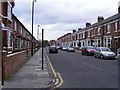
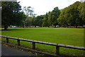
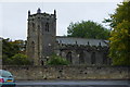
Photos of NE28 6HP


Area Information
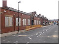
Living in NE28 6HP means inhabiting a small, densely populated residential cluster in England. The area covers just 7,800 square metres, yet it houses 1,337 people, translating to a population density of 171,412 per square kilometre. This compact postcode is characterised by its proximity to transport hubs and retail centres, making it a practical choice for those prioritising connectivity. The community here is predominantly composed of adults aged 30–64, with a median age of 47. While the area is small, it offers access to multiple rail stations, ferry terminals, and local shops, reflecting a blend of urban convenience and residential simplicity. The high population density may mean limited space for expansion, but the area’s infrastructure supports a compact, efficient lifestyle. For buyers, NE28 6HP presents a niche market, with homes primarily in the private rental sector due to the 38% home ownership rate. The area’s appeal lies in its accessibility and the presence of essential services, though its size means any property here is likely to be part of a tightly knit neighbourhood.
- Area Type
- Postcode
- Area Size
- 7800 m²
- Population
- 1337
- Population Density
- 171412 people/km²
The property market in NE28 6HP is shaped by its small size and high population density. With 38% of residents owning their homes, the area is more rental-focused than owner-occupied, which may affect availability and competition for properties. The accommodation type is predominantly houses, though the limited space suggests these are likely compact, single-family homes rather than larger detached properties. Given the area’s size, the housing stock is unlikely to be extensive, meaning buyers may find few options within NE28 6HP itself. Those seeking homes here would need to consider the immediate surrounding areas for more choices. The high density also implies that properties are closely spaced, which could be a consideration for those prioritising privacy or space. For investors, the rental market’s dominance may offer steady returns, but the small footprint of the area means demand is likely to be high relative to supply. Buyers should approach the market with realistic expectations, recognising that NE28 6HP is a niche, tightly packed postcode with limited expansion potential.
House Prices in NE28 6HP
No properties found in this postcode.
Energy Efficiency in NE28 6HP
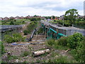
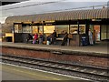
Daily life in NE28 6HP is shaped by its proximity to essential amenities. The area’s retail options include major supermarkets like Asda Wallsend and Iceland Wallsend, as well as smaller shops such as Heron Wallsend, providing convenience for grocery shopping. Transport links are extensive, with five metro stops, five rail stations, and two ferry terminals offering access to nearby cities and coastal destinations. The presence of multiple rail stations, including Heworth Railway Station, facilitates commuting to larger urban centres. For leisure, the area’s connectivity to ferry services opens up opportunities for trips to nearby harbours and coastal towns. While specific parks or recreational spaces are not listed in the data, the high density of services suggests a focus on urban living rather than green spaces. The combination of retail, transport, and regional connectivity makes NE28 6HP a practical choice for those prioritising accessibility over expansive natural amenities.
Amenities
Schools
The nearest school to NE28 6HP is Carville Primary School, which serves the local community. The data lists this school twice, but it is the only named educational institution in the area. As a primary school, it caters to younger children, though there is no information provided on its Ofsted rating or performance. The absence of secondary schools or other educational institutions in the data means families may need to look beyond NE28 6HP for comprehensive schooling options. For those prioritising proximity to schools, Carville Primary School offers a local solution, but parents should investigate further to understand its quality and capacity. The single primary school in the area may indicate a reliance on nearby districts for secondary education, which could be a factor for families planning long-term in the region.
| Rank | School | Type | Entry gender | Ages |
|---|
Explore more schools in this area
Go to Schools tabDemographics
The demographic profile of NE28 6HP is defined by its adult population, with 30–64-year-olds forming the most common age group. The median age of 47 suggests a mature community, likely with established careers and families. Home ownership is relatively low at 38%, indicating that the majority of residents are renters, which may influence the local property market’s dynamics. The accommodation type is predominantly houses, though the high population density implies these are likely smaller, closely spaced properties. The predominant ethnic group is White, with no data provided on other demographics. The area’s compact size and high density may contribute to a sense of community, but the lack of diversity data means it is difficult to assess broader social composition. For buyers, the 38% home ownership rate suggests a rental-heavy market, which could impact long-term investment potential. The absence of specific data on deprivation or income levels means quality of life factors remain unquantified, though the area’s infrastructure and amenities suggest a functional, if limited, living environment.
Household Size
Accommodation Type
Tenure
Ethnic Group
Religion
Household Composition
Age
Household Deprivation
NS-SEC
Explore more demographic insights in this area
Go to Demographics tabPlanning
Planning Constraints
- Flood RiskPremium
- Ramsar Wetland SitesPremium
- Area of Outstanding Natural BeautyPremium
- Protected Nature ReservePremium
- Protected WoodlandPremium
- Crime & SafetyPremium