Area Overview for NE28 0QE
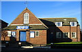
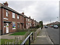
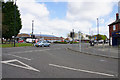
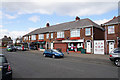
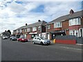
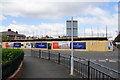
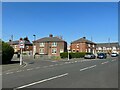
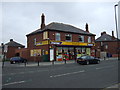
Photos of NE28 0QE


Area Information
NE28 0QE is a small residential postcode area in England, home to 1,675 residents. Its compact size means it is a tightly knit community, with a focus on local living. The area is characterised by a mix of housing stock, predominantly homes rather than flats, catering to a population skewed towards adults aged 30-64. This demographic suggests a mature, stable community with established families and professionals. The proximity to transport hubs, including rail stations and ferry terminals, ensures connectivity to nearby cities like Newcastle and South Shields. Residents benefit from excellent broadband connectivity, scoring 100 out of 100, which supports remote work and daily internet use. However, the area’s crime risk is high, with a safety score of 26 out of 100, requiring residents to consider security measures. Despite this, the absence of environmental constraints like protected woodlands or AONB designations means development is not restricted. Living here offers a balance of convenience and community, though buyers should weigh the safety factors against the area’s practical advantages.
- Area Type
- Postcode
- Area Size
- Not available
- Population
- 1675
- Population Density
- Not available
The property market in NE28 0QE is shaped by its low home ownership rate of 29%, indicating that the area is primarily a rental market rather than one dominated by owner-occupied homes. The accommodation type is predominantly houses, which may appeal to families or individuals seeking larger living spaces. This contrasts with areas where flats or apartments are more common. Given the small population and compact nature of the postcode, the housing stock is limited, and buyers should consider the area’s size when exploring options. The focus on houses suggests that properties here are likely to be family-friendly, with potential for long-term residency. However, the low home ownership rate means competition for available homes could be higher, and buyers should assess the local rental market before committing.
House Prices in NE28 0QE
No properties found in this postcode.
Energy Efficiency in NE28 0QE
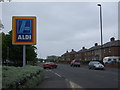
Daily life in NE28 0QE is supported by a range of nearby amenities, including five metro stations, five retail outlets, and two ferry terminals. Local shops such as Spar and Aldi Howdon provide essential services, while the ferry terminals connect residents to larger cities like Newcastle and South Shields. The area’s rail network, with stations like Railway Station and Brockley Whins Railway Station, offers easy access to regional hubs. Though specific parks or leisure facilities are not listed, the presence of multiple transport and retail options suggests a practical, community-focused lifestyle. The mix of retail, transport, and dining options ensures that residents can meet their daily needs without traveling far, contributing to a convenient and connected living experience.
Amenities
Schools
Residents of NE28 0QE have access to several primary schools, including Stephenson Memorial Primary School and Bewicke First School. These institutions are likely to serve the needs of local families with young children, though no Ofsted ratings are provided in the data. The presence of multiple primary schools suggests a focus on early education, which is a key consideration for families. However, the absence of secondary schools or further education facilities within the area means that students may need to travel to nearby towns for higher-level education. The mix of primary schools indicates a capacity to accommodate local demand, but buyers should investigate the quality and capacity of these schools to ensure they meet their children’s needs.
| Rank | School | Type | Entry gender | Ages |
|---|
Explore more schools in this area
Go to Schools tabDemographics
The population of NE28 0QE is 1,675, with a median age of 47. The majority of residents are adults aged 30-64, indicating a mature community with a focus on stability. Home ownership is relatively low at 29%, suggesting that most residents rent their properties. The accommodation type is predominantly houses, which contrasts with areas where flats are more common. The predominant ethnic group is White, though no specific data on diversity or deprivation is provided. This demographic profile implies a community with established families and professionals, but limited data on household composition or socioeconomic factors means further analysis is not possible. The age range and home ownership rate suggest a mix of long-term residents and those seeking rental properties in a small, defined area.
Household Size
Accommodation Type
Tenure
Ethnic Group
Religion
Household Composition
Age
Household Deprivation
NS-SEC
Explore more demographic insights in this area
Go to Demographics tabPlanning
Planning Constraints
- Flood RiskPremium
- Ramsar Wetland SitesPremium
- Area of Outstanding Natural BeautyPremium
- Protected Nature ReservePremium
- Protected WoodlandPremium