Area Overview for NE28 0QD
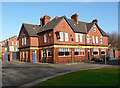
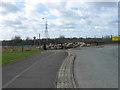
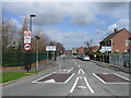
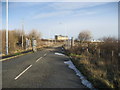
Photos of NE28 0QD


Area Information
Living in NE28 0QD means being part of a compact residential cluster in England, where 1,728 people reside across a densely populated area. The postcode covers a small but well-connected community, with homes predominantly in the form of houses. The median age of 47 suggests a mature demographic, with adults aged 30–64 making up the largest share of the population. Daily life here is shaped by proximity to transport networks, including rail stations, ferry terminals, and metro stops, which link residents to nearby towns like Jarrow and Howdon. The area’s proximity to Percy Main Primary School, rated good by Ofsted, adds to its appeal for families. While the population density is high at 1,429 people per square kilometre, the community retains a local character, with shops like Iceland Jarrow and Morrisons providing essential services. NE28 0QD is not a sprawling suburb but a tightly knit area where convenience and connectivity are key.
- Area Type
- Postcode
- Area Size
- Not available
- Population
- 1728
- Population Density
- 1429 people/km²
The property market in NE28 0QD is dominated by houses, with 27% of homes owned by residents and the remainder likely rented. This suggests a rental market that caters to a population with a median age of 47, where many may be renting due to life stages such as retirement or career mobility. The housing stock is not diverse in terms of accommodation types, with no mention of flats or newer developments. For buyers, this small area’s limited size means the housing options are constrained, but the presence of nearby towns like Jarrow and Howdon may offer more choices. The focus on houses implies a preference for family homes, though the low home ownership rate could indicate limited opportunities for long-term investment. Buyers should consider the area’s compact nature and its role as a satellite to larger towns for broader property options.
House Prices in NE28 0QD
Showing 3 properties
| Address | Type | Beds | Baths | Last Sale Price | Last Sale Date | |
|---|---|---|---|---|---|---|
| Northumbrian Water Scientific Services, Gregsons Buildings, Northumberland Dock Road, East Howdon, Wallsend, NE28 0QD | Office | - | - | - | - | |
| Vehicle Leasing Services, Northumberland Dock Road, East Howdon, Wallsend, NE28 0QD | warehouse | - | - | - | - | |
| Warehouse, Howdon Yard, Tyne View Terrace, Wallsend, NE28 0QD | warehouse | - | - | - | - |
Energy Efficiency in NE28 0QD
Residents of NE28 0QD have access to a range of amenities within practical reach. Retail options include Morrisons Daily, Iceland Jarrow, and Morrisons Jarrow, providing essential shopping for groceries and household items. The area’s transport links, such as rail stations and ferry terminals, enhance connectivity to larger towns like Jarrow and South Shields. While the data does not mention parks or leisure facilities explicitly, the presence of multiple metro stops and ferry access suggests opportunities for recreation in nearby areas. The compact nature of the postcode means amenities are concentrated, offering convenience for daily needs. The combination of retail, transport, and proximity to larger towns creates a lifestyle that balances local convenience with broader regional access.
Amenities
Schools
The nearest school to NE28 0QD is Percy Main Primary School, a primary institution with a good Ofsted rating. This school serves the local community, providing education for younger children in the area. Families relying on this school may find its rating reassuring, though no secondary schools are listed in the data. The absence of higher education institutions nearby means students may need to travel to larger towns for secondary schooling. The single primary school available reflects the area’s small size, which limits the range of educational options. For parents prioritising proximity to schools, Percy Main Primary School is a key asset, but the lack of additional schools may require planning for longer commutes.
| Rank | School | Type | Entry gender | Ages |
|---|
Explore more schools in this area
Go to Schools tabDemographics
The community in NE28 0QD is defined by its median age of 47, with adults aged 30–64 forming the majority. Home ownership is relatively low at 27%, indicating that many residents are renters. The area is predominantly composed of houses, reflecting a traditional housing stock rather than flats or apartments. The predominant ethnic group is White, though no data on diversity or deprivation is provided. The high population density of 1,429 people per square kilometre suggests a compact, closely packed residential environment. This demographic profile points to a mature, stable population with established routines, though the low home ownership rate may indicate a reliance on rental properties. The area’s character is shaped by its residents’ age and housing preferences, creating a distinct local identity.
Household Size
Accommodation Type
Tenure
Ethnic Group
Religion
Household Composition
Age
Household Deprivation
NS-SEC
Explore more demographic insights in this area
Go to Demographics tabPlanning
Planning Constraints
- Flood RiskPremium
- Ramsar Wetland SitesPremium
- Area of Outstanding Natural BeautyPremium
- Protected Nature ReservePremium
- Protected WoodlandPremium