Area Overview for NE28 0HL
Photos of NE28 0HL
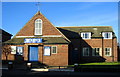
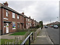

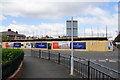
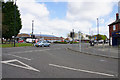
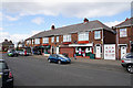

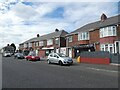
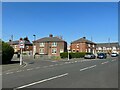
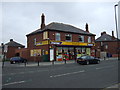
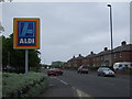
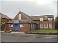
19 photos from this area
Area Information
Key information about the NE28 0HL including its size, population, and administrative classification.
- Area Type
- Postcode
- Area Size
- 7619 m²
- Population
- 1581
- Population Density
- 207503 people/km²
House Prices in NE28 0HL
32
Properties
£95,765
Average Sold Price
£35,500
Lowest Price
£150,000
Highest Price
Showing 32 properties
| Address | Type | Beds | Baths | Last Sale Price | Last Sale Date | |
|---|---|---|---|---|---|---|
| 85 Melrose Gardens, Wallsend, NE28 0HL | house | 3 | - | £105,000 | Mar 2023 | |
| 99 Melrose Gardens, Wallsend, NE28 0HL | Semi-detached | - | - | £93,000 | Mar 2022 | |
| 63 Melrose Gardens, Wallsend, NE28 0HL | Terraced | 3 | - | £124,000 | Sep 2021 | |
| 89 Melrose Gardens, Wallsend, NE28 0HL | house | - | - | £150,000 | Feb 2021 | |
| 87 Melrose Gardens, Wallsend, NE28 0HL | Semi-detached | 2 | - | £130,000 | Dec 2020 | |
| 83 Melrose Gardens, Wallsend, NE28 0HL | Terraced | 3 | 1 | £135,000 | Jul 2019 | |
| 71 Melrose Gardens, Wallsend, NE28 0HL | Terraced | 3 | 2 | £105,000 | Oct 2013 | |
| 61 Melrose Gardens, Wallsend, NE28 0HL | Terraced | 3 | 1 | £74,000 | Sep 2011 | |
| 75 Melrose Gardens, Wallsend, NE28 0HL | house | 3 | - | £83,000 | Jul 2011 | |
| 69 Melrose Gardens, Wallsend, NE28 0HL | house | - | - | £82,500 | Mar 2010 |
Page 1 of 4
Energy Efficiency in NE28 0HL
Amenities
Schools
| Rank | School | Type | Entry gender | Ages |
|---|
Explore more schools in this area
Go to Schools tabDemographics
Household Size
Family (3-5 people)
most common
Accommodation Type
Houses
most common
Tenure
54
majority
Ethnic Group
White
most common
Religion
N/A
most common
Household Composition
N/A
most common
Age
47
median
Adults (30-64 years)
most common
Household Deprivation
N/A
with no deprivation
NS-SEC
19
in Lower managerial occupations
Explore more demographic insights in this area
Go to Demographics tabPlanning
Planning Constraints
- Flood RiskPremium
- Ramsar Wetland SitesPremium
- Area of Outstanding Natural BeautyPremium
- Protected Nature ReservePremium
- Protected WoodlandPremium