Area Overview for NE28 0EP
Photos of NE28 0EP
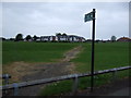
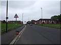
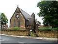
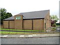
23 photos from this area
Area Information
Key information about the NE28 0EP including its size, population, and administrative classification.
- Area Type
- Postcode
- Area Size
- 1.6 hectares
- Population
- 1698
- Population Density
- 5451 people/km²
House Prices in NE28 0EP
11
Properties
£86,500
Average Sold Price
£38,000
Lowest Price
£145,000
Highest Price
Showing 11 properties
| Address | Type | Beds | Baths | Last Sale Price | Last Sale Date | |
|---|---|---|---|---|---|---|
| 104 Coniston Road, Howdon, Wallsend, NE28 0EP | Terraced | 3 | 1 | £145,000 | Aug 2023 | |
| 102 Coniston Road, Howdon, Wallsend, NE28 0EP | Terraced | 3 | 1 | £76,500 | Sep 2014 | |
| 106 Coniston Road, Howdon, Wallsend, NE28 0EP | Terraced | - | - | £38,000 | Mar 2000 | |
| 100 Coniston Road, Howdon, Wallsend, NE28 0EP | house | - | - | - | - | |
| Playing Field At, St Aidans Roman Catholic Primary School, Coniston Road, Howdon, Wallsend, NE28 0EP | Leisure | - | - | - | - | |
| Little Sunshine Childcare, Nursery Unit, St Aidans Roman Catholic Primary School, Coniston Road, Howdon, Wallsend, NE28 0EP | commercial | - | - | - | - | |
| 108 Coniston Road, Howdon, Wallsend, NE28 0EP | house | - | - | - | - | |
| 112 Coniston Road, Howdon, Wallsend, NE28 0EP | house | - | - | - | - | |
| 110 Coniston Road, Howdon, Wallsend, NE28 0EP | house | - | - | - | - | |
| Our Lady And St Aidans Church Presbytery, Coniston Road, Howdon, Wallsend, NE28 0EP | Semi-detached | - | - | - | - |
Page 1 of 2
Energy Efficiency in NE28 0EP
Amenities
Schools
| Rank | School | Type | Entry gender | Ages |
|---|
Explore more schools in this area
Go to Schools tabDemographics
Household Size
One person
most common
Accommodation Type
Houses
most common
Tenure
38
majority
Ethnic Group
White
most common
Religion
N/A
most common
Household Composition
N/A
most common
Age
47
median
Adults (30-64 years)
most common
Household Deprivation
N/A
with no deprivation
NS-SEC
19
in Lower managerial occupations
Explore more demographic insights in this area
Go to Demographics tabPlanning
Planning Constraints
- Flood RiskPremium
- Ramsar Wetland SitesPremium
- Area of Outstanding Natural BeautyPremium
- Protected Nature ReservePremium
- Protected WoodlandPremium