Area Overview for NE27 0LP
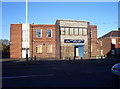
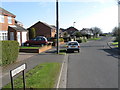
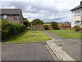
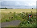
Photos of NE27 0LP


Area Information
Living in NE27 0LP means being part of a tightly knit residential cluster in England, where 1,445 people reside across 1.4 hectares. This small area has a population density of 957 people per square kilometre, creating a close-knit community feel. The median age of 47 suggests a mature demographic, with most residents aged between 30 and 64. Daily life here is characterised by proximity to essential services, including five retail outlets like Tesco Shiremoor and Sainsburys Northumberland. The area’s compact size means amenities are within practical reach, though its small footprint means it’s best suited for those prioritising convenience over sprawling landscapes. With no major planning constraints or environmental risks, NE27 0LP offers a straightforward, low-maintenance lifestyle. However, its limited size means it’s not ideal for those seeking expansive outdoor spaces. The area’s mix of homeownership and rental properties reflects a balance between long-term residents and those seeking temporary accommodation. For buyers, this postcode represents a focused, community-oriented environment with clear advantages for families and professionals alike.
- Area Type
- Postcode
- Area Size
- 1.4 hectares
- Population
- 1445
- Population Density
- 957 people/km²
The property market in NE27 0LP is defined by a 49% home ownership rate, with the majority of properties being houses. This suggests a market skewed towards owner-occupied homes rather than a high proportion of rental properties. The small area size means the housing stock is limited, with no indication of high-rise or commercial developments. For buyers, this implies a focus on individual, family-friendly homes rather than investment opportunities in larger complexes. The absence of significant planning constraints or environmental risks makes the area attractive for those seeking straightforward, low-risk purchases. However, the compact nature of the postcode means the immediate surroundings are crucial for finding additional properties. Prospective buyers should consider the area’s proximity to amenities like schools and transport, which are key factors in property value. The mix of homeowners and renters also means competition for available homes could be moderate, depending on local demand.
House Prices in NE27 0LP
No properties found in this postcode.
Energy Efficiency in NE27 0LP
The lifestyle in NE27 0LP is shaped by its proximity to a range of amenities, from retail to transport. Residents can access five retail outlets, including major supermarkets like Tesco Shiremoor and Sainsburys Northumberland, ensuring daily shopping needs are met locally. The area’s metro, rail, and ferry connections provide easy access to nearby towns and cities, while the single bus stop at Rhodes Street offers an alternative for local travel. Although the data does not specify parks or leisure facilities, the lack of environmental constraints like protected woodlands or AONB designations suggests open spaces may be limited. The presence of two primary schools and a mix of transport options supports a family-friendly environment. However, the small area size means residents may need to venture further for specialist services or larger recreational areas. The balance of convenience and accessibility makes NE27 0LP suitable for those valuing practicality in their daily lives.
Amenities
Schools
Residents of NE27 0LP have access to two primary schools: New York Primary School, which holds an Ofsted rating of outstanding, and Moorhouse Primary School. Both institutions serve the local community, providing education for younger children. The presence of two primary schools within reach is a significant advantage for families, reducing the need for long commutes. However, the data does not include secondary schools or further education facilities, so families may need to look beyond the immediate area for comprehensive schooling. The Ofsted rating of outstanding for New York Primary School indicates high-quality education, which could be a deciding factor for parents prioritising academic standards. Overall, the availability of primary schools supports the area’s appeal to families, though additional research may be needed for secondary education options.
| Rank | School | Type | Entry gender | Ages |
|---|
Explore more schools in this area
Go to Schools tabDemographics
NE27 0LP’s population is predominantly adults aged 30 to 64, with a median age of 47. This suggests a community of established professionals and families, rather than a younger or elderly demographic. Home ownership accounts for 49% of properties, with the remaining 51% likely occupied by renters, indicating a mix of long-term residents and transient occupants. The accommodation type is primarily houses, which aligns with the area’s residential character and suggests a focus on family homes. The predominant ethnic group is White, though specific data on diversity is not provided. The age profile and ownership rates imply a stable, settled community with limited turnover. The population density of 957 per square kilometre means living spaces are closely packed, which could influence the character of the area. For those considering NE27 0LP, this demographic profile suggests a mature, low-chaos environment with a focus on practicality over novelty.
Household Size
Accommodation Type
Tenure
Ethnic Group
Religion
Household Composition
Age
Household Deprivation
NS-SEC
Explore more demographic insights in this area
Go to Demographics tabPlanning
Planning Constraints
- Flood RiskPremium
- Ramsar Wetland SitesPremium
- Area of Outstanding Natural BeautyPremium
- Protected Nature ReservePremium
- Protected WoodlandPremium