Area Overview for NE26 4AG
Photos of NE26 4AG
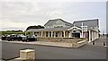
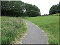
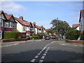
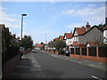
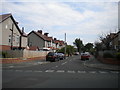
54 photos from this area
Area Information
Key information about the NE26 4AG including its size, population, and administrative classification.
- Area Type
- Postcode
- Area Size
- 1.1 hectares
- Population
- 1428
- Population Density
- 648 people/km²
House Prices in NE26 4AG
24
Properties
£257,973
Average Sold Price
£103,500
Lowest Price
£405,000
Highest Price
Showing 24 properties
| Address | Type | Beds | Baths | Last Sale Price | Last Sale Date | |
|---|---|---|---|---|---|---|
| 58 Hastings Avenue, Whitley Bay, NE26 4AG | house | 3 | 1 | £382,000 | Jun 2025 | |
| 49 Hastings Avenue, Whitley Bay, NE26 4AG | Bungalow | 2 | 1 | £405,000 | Feb 2023 | |
| 54 Hastings Avenue, Whitley Bay, NE26 4AG | Bungalow | - | - | £360,000 | Nov 2021 | |
| 79 Hastings Avenue, Whitley Bay, NE26 4AG | house | - | - | £335,000 | Jun 2020 | |
| 46 Hastings Avenue, Whitley Bay, NE26 4AG | Bungalow | 3 | - | £389,000 | Jan 2017 | |
| 71 Hastings Avenue, Whitley Bay, NE26 4AG | Bungalow | - | - | £287,000 | Aug 2016 | |
| 75 Hastings Avenue, Whitley Bay, NE26 4AG | Bungalow | 2 | - | £240,000 | Oct 2015 | |
| 63 Hastings Avenue, Whitley Bay, NE26 4AG | Bungalow | 3 | - | £293,000 | May 2015 | |
| 69 Hastings Avenue, Whitley Bay, NE26 4AG | Bungalow | 2 | - | £250,000 | Apr 2014 | |
| 67 Hastings Avenue, Whitley Bay, NE26 4AG | Bungalow | - | - | £245,000 | Dec 2013 |
Page 1 of 3
Energy Efficiency in NE26 4AG
Amenities
Schools
| Rank | School | Type | Entry gender | Ages |
|---|
Explore more schools in this area
Go to Schools tabDemographics
Household Size
Two person
most common
Accommodation Type
Houses
most common
Tenure
93
majority
Ethnic Group
White
most common
Religion
N/A
most common
Household Composition
N/A
most common
Age
47
median
Adults (30-64 years)
most common
Household Deprivation
N/A
with no deprivation
NS-SEC
52
in Lower managerial occupations
Explore more demographic insights in this area
Go to Demographics tabPlanning
Planning Constraints
- Flood RiskPremium
- Ramsar Wetland SitesPremium
- Area of Outstanding Natural BeautyPremium
- Protected Nature ReservePremium
- Protected WoodlandPremium