Area Overview for NE26 3EF
Photos of NE26 3EF
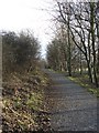
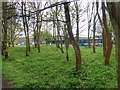
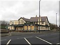
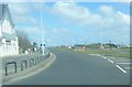
54 photos from this area
Area Information
Key information about the NE26 3EF including its size, population, and administrative classification.
- Area Type
- Postcode
- Area Size
- 8447 m²
- Population
- 1537
- Population Density
- 606 people/km²
House Prices in NE26 3EF
19
Properties
£249,859
Average Sold Price
£62,250
Lowest Price
£404,000
Highest Price
Showing 19 properties
| Address | Type | Beds | Baths | Last Sale Price | Last Sale Date | |
|---|---|---|---|---|---|---|
| 66 Cragside, Whitley Lodge, Whitley Bay, NE26 3EF | Semi-detached | 2 | 1 | £365,000 | Jun 2023 | |
| 64 Cragside, Whitley Lodge, Whitley Bay, NE26 3EF | Bungalow | 2 | - | £300,000 | Jun 2023 | |
| 53 Cragside, Whitley Lodge, Whitley Bay, NE26 3EF | house | - | - | £300,000 | Dec 2019 | |
| 67 Cragside, Whitley Lodge, Whitley Bay, NE26 3EF | house | - | - | £295,500 | Nov 2019 | |
| 61 Cragside, Whitley Lodge, Whitley Bay, NE26 3EF | Semi-detached | 3 | 1 | £292,000 | May 2019 | |
| 76 Cragside, Whitley Lodge, Whitley Bay, NE26 3EF | house | - | - | £297,500 | Oct 2018 | |
| 58 Cragside, Whitley Lodge, Whitley Bay, NE26 3EF | Detached | 4 | 2 | £404,000 | Sep 2018 | |
| 57 Cragside, Whitley Lodge, Whitley Bay, NE26 3EF | house | - | - | £270,000 | Aug 2018 | |
| 72 Cragside, Whitley Lodge, Whitley Bay, NE26 3EF | Bungalow | - | - | £220,000 | Jun 2018 | |
| 60 Cragside, Whitley Lodge, Whitley Bay, NE26 3EF | Bungalow | 2 | - | £220,000 | Sep 2015 |
Page 1 of 2
Energy Efficiency in NE26 3EF
Amenities
Schools
| Rank | School | Type | Entry gender | Ages |
|---|
Explore more schools in this area
Go to Schools tabDemographics
Household Size
Two person
most common
Accommodation Type
Houses
most common
Tenure
90
majority
Ethnic Group
White
most common
Religion
N/A
most common
Household Composition
N/A
most common
Age
47
median
Adults (30-64 years)
most common
Household Deprivation
N/A
with no deprivation
NS-SEC
48
in Lower managerial occupations
Explore more demographic insights in this area
Go to Demographics tabPlanning
Planning Constraints
- Flood RiskPremium
- Ramsar Wetland SitesPremium
- Area of Outstanding Natural BeautyPremium
- Protected Nature ReservePremium
- Protected WoodlandPremium