Area Overview for NE23 8HP
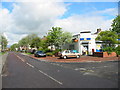
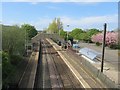
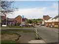
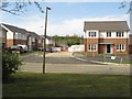
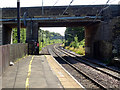
Photos of NE23 8HP
Area Information
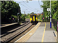
Living in NE23 8HP means being part of a compact, residential cluster in England’s northeast, where 2,190 people reside across a densely populated area. The postcode’s high population density of 1,440 people per square kilometre suggests a tight-knit community, likely centred around local amenities and transport links. This area is not a sprawling suburb but a focused cluster, making it practical for daily life. Residents benefit from proximity to multiple rail stations, including Cramlington Railway Station, and nearby retail hubs like M&S Cramlington and Asda Cramlington. The area’s appeal lies in its balance of accessibility and residential tranquillity, with no major environmental constraints like protected woodlands or wetlands. While it lacks the sprawling green spaces of larger towns, its strategic location near Newcastle Airport and metro stops like Northumberland Park ensures connectivity to broader regions. For those seeking a stable, community-oriented environment with practical infrastructure, NE23 8HP offers a straightforward, no-frills lifestyle.
- Area Type
- Postcode
- Area Size
- Not available
- Population
- 2190
- Population Density
- 1440 people/km²
NE23 8HP is predominantly a home-ownership area, with 62% of residents living in properties they own. The accommodation type is largely houses, which suggests a market skewed towards family homes and long-term residents rather than a rental-focused or student-dominated area. This composition implies limited turnover in the property market, which can be both a strength and a limitation. For buyers, the scarcity of rental properties means the area may not be ideal for those seeking investment opportunities or short-term lets. However, the prevalence of houses could indicate a demand for spacious, private living, which may appeal to families. Given the area’s small size, buyers should consider nearby postcode clusters for more options. The stability of ownership also means property values are likely to reflect the area’s established nature, with fewer speculative fluctuations.
House Prices in NE23 8HP
Showing 13 properties
| Address | Type | Beds | Baths | Last Sale Price | Last Sale Date | |
|---|---|---|---|---|---|---|
| 13 Hazel Road, West Meadows, Cramlington, NE23 8HP | house | - | - | - | - | |
| 5 Hazel Road, West Meadows, Cramlington, NE23 8HP | house | - | - | - | - | |
| 11 Hazel Road, West Meadows, Cramlington, NE23 8HP | house | - | - | - | - | |
| 17 Hazel Road, West Meadows, Cramlington, NE23 8HP | house | - | - | - | - | |
| 4 Hazel Road, West Meadows, Cramlington, NE23 8HP | house | - | - | - | - | |
| 3 Hazel Road, West Meadows, Cramlington, NE23 8HP | house | - | - | - | - | |
| 9 Hazel Road, West Meadows, Cramlington, NE23 8HP | Detached | - | - | - | - | |
| 15 Hazel Road, West Meadows, Cramlington, NE23 8HP | house | - | - | - | - | |
| 7 Hazel Road, West Meadows, Cramlington, NE23 8HP | house | - | - | - | - | |
| 10 Hazel Road, West Meadows, Cramlington, NE23 8HP | house | - | - | - | - |
Energy Efficiency in NE23 8HP
The lifestyle in NE23 8HP is shaped by its proximity to retail, transport, and regional hubs. Residents have access to major retailers like M&S Cramlington, Iceland Cramlington, and Asda Cramlington, ensuring everyday shopping needs are met locally. The five rail stations and five metro stops, including Palmersville and Wansbeck Road, provide easy access to nearby towns and cities, while Newcastle Airport is within reach for travel. Though the area lacks detailed information on parks or leisure facilities, its transport links suggest a lifestyle focused on convenience and connectivity. The mix of retail, transport, and regional access means daily life is practical, with minimal need to travel far for essentials. For those prioritising accessibility over sprawling green spaces, NE23 8HP offers a straightforward, functional environment.
Amenities
Schools
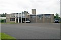
The nearest school to NE23 8HP is Beaconhill Community Primary School, which holds a ‘good’ Ofsted rating. This institution serves the local primary education needs of the area, though no secondary schools are listed in the data. The presence of a well-rated primary school is a key consideration for families with young children, as it reduces the need to commute to distant schools. However, the absence of secondary education options within the postcode means parents may need to plan for transportation to nearby towns for older children. The school’s rating suggests a reasonable standard of teaching and facilities, which could be a deciding factor for families prioritising education quality. For those seeking a school-centric lifestyle, NE23 8HP’s primary school is a positive feature, but secondary schooling remains a practical consideration.
| Rank | School | Type | Entry gender | Ages |
|---|
Explore more schools in this area
Go to Schools tabDemographics
NE23 8HP has a median age of 47, with the majority of residents falling into the 30-64 age range. This suggests a mature, family-focused population, likely with established careers and long-term commitments to the area. Home ownership rates stand at 62%, indicating a stable housing market where most residents live in properties they own rather than rent. The predominant accommodation type is houses, which aligns with the age profile—older adults and families often prefer single-family homes. The area’s demographic is largely homogenous, with White residents making up the majority. While no specific data on deprivation or diversity is provided, the age and ownership figures imply a community prioritising security and continuity over rapid change. This profile may appeal to those seeking a settled environment with minimal turnover, though it also means the area’s character is unlikely to shift significantly.
Household Size
Accommodation Type
Tenure
Ethnic Group
Religion
Household Composition
Age
Household Deprivation
NS-SEC
Explore more demographic insights in this area
Go to Demographics tabPlanning
Planning Constraints
- Flood RiskPremium
- Ramsar Wetland SitesPremium
- Area of Outstanding Natural BeautyPremium
- Protected Nature ReservePremium
- Protected WoodlandPremium