Area Overview for NE23 8BJ
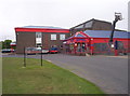
Photos of NE23 8BJ


Area Information
Living in NE23 8BJ offers a compact, residential experience shaped by its small footprint of 2.6 hectares and a population of 2,048. This postcode area is a tight-knit cluster of homes, with a population density of 209 people per square kilometre, suggesting a balance between private space and community proximity. The area’s character is defined by its practical layout, with easy access to essential services and transport links. Residents benefit from being close to multiple railway stations, including Cramlington Railway Station, and a network of metro stops such as Wansbeck Road and Fawdon. The surrounding region includes retail hubs like M&S Cramlington and Asda Cramlington, ensuring daily needs are met without long commutes. While the area is small, it is well-connected to Newcastle Airport, making travel straightforward. The demographic profile—primarily adults aged 30–64—hints at a mature, stable community, with homes predominantly in single-family structures. For those seeking a quiet, functional living environment with accessible amenities, NE23 8BJ provides a foundation for a practical lifestyle.
- Area Type
- Postcode
- Area Size
- 2.6 hectares
- Population
- 2048
- Population Density
- 209 people/km²
The property market in NE23 8BJ is characterised by a 41% home ownership rate, indicating that nearly half of the housing stock is rented. This suggests a rental market that may cater to both long-term tenants and those seeking temporary accommodation. The accommodation type is predominantly houses, which contrasts with areas where flats or apartments dominate. This housing profile likely appeals to families or individuals prioritising space and privacy. Given the area’s small size, the property stock is limited, meaning buyers should consider nearby areas for more options. The presence of single-family homes may also influence local property values, with potential for appreciation in a stable market. However, the relatively low home ownership rate could indicate competition among renters, potentially affecting availability. For buyers, the focus on houses may mean fewer high-density developments, but the existing stock offers a straightforward, traditional living experience.
House Prices in NE23 8BJ
Showing 2 properties
| Address | Type | Beds | Baths | Last Sale Price | Last Sale Date | |
|---|---|---|---|---|---|---|
| Wright Shine Cic, Wright Shine, Azure Garden Centre, Station Road, Cramlington, NE23 8BJ | shop | - | - | - | - | |
| Azure, Azure Garden Centre, Station Road, Cramlington, NE23 8BJ | shop | - | - | - | - |
Energy Efficiency in NE23 8BJ
Residents of NE23 8BJ have access to a range of amenities within walking or short driving distance. Retail options include major chains such as M&S Cramlington, Iceland Cramlington, and Asda Cramlington, offering everything from groceries to clothing. The area’s rail network, with five stations including Cramlington Railway Station, and metro stops like Regent Centre and Fawdon, facilitate easy travel to nearby towns and cities. While the data does not specify parks or leisure facilities, the presence of multiple transport hubs and retail centres suggests a lifestyle focused on convenience and connectivity. The compact nature of the area means amenities are not overly spread out, reducing the need for long commutes. For those prioritising accessibility and practicality, NE23 8BJ’s amenities support a balanced daily life, blending local convenience with regional reach.
Amenities
Schools
| Rank | School | Type | Entry gender | Ages |
|---|
Explore more schools in this area
Go to Schools tabDemographics
NE23 8BJ’s population of 2,048 is predominantly composed of adults aged 30–64, with a median age of 47. This suggests a community of middle-aged individuals, likely in their prime working years, with a focus on stability and long-term living. Home ownership in the area stands at 41%, indicating a mix of owner-occupied properties and rental homes. The accommodation type is largely houses, which aligns with the demographic’s preference for single-family living. The predominant ethnic group is White, reflecting a homogenous cultural profile. While no data on deprivation is provided, the moderate population density and availability of local amenities suggest a quality of life that balances privacy with convenience. The age distribution and housing stock imply a community that values established, family-friendly environments, though the relatively low home ownership rate may point to a market where rental options are more prevalent.
Household Size
Accommodation Type
Tenure
Ethnic Group
Religion
Household Composition
Age
Household Deprivation
NS-SEC
Explore more demographic insights in this area
Go to Demographics tabPlanning
Planning Constraints
- Flood RiskPremium
- Ramsar Wetland SitesPremium
- Area of Outstanding Natural BeautyPremium
- Protected Nature ReservePremium
- Protected WoodlandPremium