Area Overview for NE23 6XN
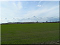
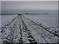
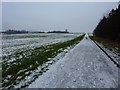
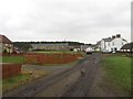
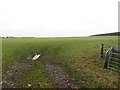
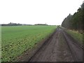
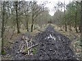
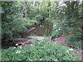
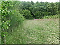
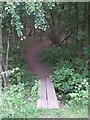
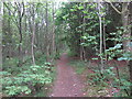
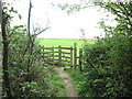
Photos of NE23 6XN
Area Information
Living in NE23 6XN offers a compact, residential experience shaped by its small cluster of homes and proximity to key services. With a population of 1,885 spread across a densely populated area—1,743 people per square kilometre—this postcode reflects a tight-knit community. The area is characterised by its mix of local amenities, including railway stations, retail outlets, and nearby metro hubs, which provide convenient access to both daily essentials and regional connectivity. The presence of Cramlington Kramel First School underscores its appeal to families, while the surrounding infrastructure supports a lifestyle balanced between suburban comfort and practicality. Though the area lacks large-scale natural features or protected landscapes, its strategic location near Newcastle Airport and multiple transport links ensures residents are well-connected to wider networks. The demographic profile, skewed toward adults aged 30–64, suggests a stable, established community where homeownership is common, shaping a lived-in atmosphere that prioritises accessibility and routine over novelty.
- Area Type
- Postcode
- Area Size
- Not available
- Population
- 1885
- Population Density
- 1743 people/km²
The property market in NE23 6XN is defined by its emphasis on owner-occupied homes, with 54% of residents owning their properties. The accommodation type is predominantly houses, which contrasts with areas where flats or apartments dominate. This suggests a housing stock that is largely traditional, with fewer high-rise developments or modern conversions. For buyers, this means a focus on individual homes rather than shared spaces, potentially appealing to those seeking private outdoor areas or larger living quarters. However, the small size of the area and its high population density may limit availability, particularly for those seeking newer builds or specific layouts. The market’s character is shaped by its proximity to transport links and retail hubs, which could influence property values. Given the moderate homeownership rate, there may be opportunities for both purchase and rental, though the data does not specify current price trends or investment potential.
House Prices in NE23 6XN
No properties found in this postcode.
Energy Efficiency in NE23 6XN
The lifestyle in NE23 6XN is shaped by its proximity to a range of amenities, from retail outlets to transport hubs. Local Co-ops such as Wheatridge and Seaton provide essential shopping, while the five railway stations offer frequent services to nearby towns and cities. Metro areas like Northumberland Park and Shiremoor contribute to a sense of suburban convenience, with parks and open spaces likely available for leisure. The area’s connection to Newcastle Airport means residents can travel easily to regional and national destinations. Though the data does not specify dining or entertainment options, the density of retail and transport links suggests a practical, service-oriented lifestyle. The mix of amenities supports both daily routines and occasional outings, creating a balance between local convenience and broader connectivity.
Amenities
Schools
The nearest school to NE23 6XN is Cramlington Kramel First School, a primary institution serving local families. While no Ofsted rating is provided, the presence of a primary school indicates that the area caters to younger residents, though it does not include secondary education options. This means families may need to travel to nearby towns for secondary schooling, which could be a consideration for those prioritising a full range of educational facilities. The single school listed suggests a limited choice for parents, though the proximity to metro areas like Northumberland Park and Shiremoor may offer alternative schooling options. The absence of additional schools in the data implies that the area is not a major hub for education, but the existing primary school serves as a foundational resource for local children.
| Rank | School | Type | Entry gender | Ages |
|---|
Explore more schools in this area
Go to Schools tabDemographics
The community in NE23 6XN is predominantly composed of adults aged 30–64, with a median age of 47. This suggests a mature, settled population, likely with established careers and family ties. Homeownership rates stand at 54%, indicating a mix of long-term residents and renters, though the accommodation type is primarily houses rather than flats. The predominant ethnic group is White, with no specific data provided on other demographics. The absence of detailed diversity metrics means the area’s cultural composition remains largely unquantified. The age profile implies a community focused on stability, with fewer young families or retirees compared to other regions. This demographic structure may influence local services, with amenities tailored to middle-aged residents rather than children or the elderly. The lack of specific deprivation data means it is unclear whether the area faces socioeconomic challenges, though the high population density could suggest a reliance on shared resources and community networks.
Household Size
Accommodation Type
Tenure
Ethnic Group
Religion
Household Composition
Age
Household Deprivation
NS-SEC
Explore more demographic insights in this area
Go to Demographics tabPlanning
Planning Constraints
- Flood RiskPremium
- Ramsar Wetland SitesPremium
- Area of Outstanding Natural BeautyPremium
- Protected Nature ReservePremium
- Protected WoodlandPremium