Area Overview for NE23 6RU
Photos of NE23 6RU
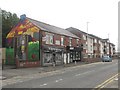
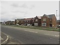
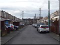
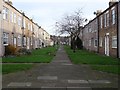
20 photos from this area
Area Information
Key information about the NE23 6RU including its size, population, and administrative classification.
- Area Type
- Postcode
- Area Size
- 1.4 hectares
- Population
- 1885
- Population Density
- 1743 people/km²
House Prices in NE23 6RU
40
Properties
£101,247
Average Sold Price
£39,000
Lowest Price
£190,000
Highest Price
Showing 40 properties
| Address | Type | Beds | Baths | Last Sale Price | Last Sale Date | |
|---|---|---|---|---|---|---|
| 29 Lanercost Park, Cramlington, NE23 6RU | Terraced | 3 | - | £48,153 | Oct 2025 | |
| 16 Lanercost Park, Cramlington, NE23 6RU | Detached | 3 | 1 | £190,000 | Aug 2024 | |
| 13 Lanercost Park, Cramlington, NE23 6RU | Terraced | 4 | - | £139,950 | Apr 2024 | |
| 7 Lanercost Park, Cramlington, NE23 6RU | Terraced | 4 | - | £148,000 | Feb 2024 | |
| 22 Lanercost Park, Cramlington, NE23 6RU | house | - | - | £110,000 | Nov 2020 | |
| 19 Lanercost Park, Cramlington, NE23 6RU | house | - | - | £129,000 | Nov 2020 | |
| 21 Lanercost Park, Cramlington, NE23 6RU | Terraced | 3 | 2 | £125,000 | Aug 2019 | |
| 9 Lanercost Park, Cramlington, NE23 6RU | Terraced | 4 | 1 | £117,000 | Apr 2018 | |
| 17 Lanercost Park, Cramlington, NE23 6RU | house | - | - | £139,950 | Jun 2016 | |
| 40 Lanercost Park, Cramlington, NE23 6RU | Detached | 3 | 1 | £124,999 | Mar 2016 |
Page 1 of 4
Energy Efficiency in NE23 6RU
Amenities
Schools
| Rank | School | Type | Entry gender | Ages |
|---|
Explore more schools in this area
Go to Schools tabDemographics
Household Size
One person
most common
Accommodation Type
Houses
most common
Tenure
54
majority
Ethnic Group
White
most common
Religion
N/A
most common
Household Composition
N/A
most common
Age
47
median
Adults (30-64 years)
most common
Household Deprivation
N/A
with no deprivation
NS-SEC
28
in Lower managerial occupations
Explore more demographic insights in this area
Go to Demographics tabPlanning
Planning Constraints
- Flood RiskPremium
- Ramsar Wetland SitesPremium
- Area of Outstanding Natural BeautyPremium
- Protected Nature ReservePremium
- Protected WoodlandPremium