Area Overview for NE22 6JH
Photos of NE22 6JH
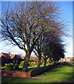
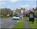
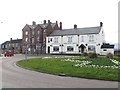
29 photos from this area
Area Information
Key information about the NE22 6JH including its size, population, and administrative classification.
- Area Type
- Postcode
- Area Size
- 6592 m²
- Population
- 1119
- Population Density
- 2349 people/km²
House Prices in NE22 6JH
21
Properties
£99,321
Average Sold Price
£37,500
Lowest Price
£160,000
Highest Price
Showing 21 properties
| Address | Type | Beds | Baths | Last Sale Price | Last Sale Date | |
|---|---|---|---|---|---|---|
| 117 Hartlands, Bedlington, NE22 6JH | house | - | - | £116,000 | Apr 2022 | |
| 111 Hartlands, Bedlington, NE22 6JH | Terraced | 3 | - | £125,000 | Aug 2020 | |
| 121 Hartlands, Bedlington, NE22 6JH | house | 3 | 1 | £102,000 | Mar 2018 | |
| 120 Hartlands, Bedlington, NE22 6JH | Terraced | - | - | £92,500 | Oct 2014 | |
| 108 Hartlands, Bedlington, NE22 6JH | house | 3 | - | £75,000 | Jul 2013 | |
| 125 Hartlands, Bedlington, NE22 6JH | house | - | - | £160,000 | Jul 2011 | |
| 113 Hartlands, Bedlington, NE22 6JH | Semi-detached | 2 | 1 | £86,565 | Nov 2007 | |
| 105 Hartlands, Bedlington, NE22 6JH | Terraced | 4 | 1 | £37,500 | Aug 2000 | |
| 112 Hartlands, Bedlington, NE22 6JH | Semi-detached | - | - | - | - | |
| 116 Hartlands, Bedlington, NE22 6JH | Terraced | - | - | - | - |
Page 1 of 3
Energy Efficiency in NE22 6JH
Amenities
Schools
| Rank | School | Type | Entry gender | Ages |
|---|
Explore more schools in this area
Go to Schools tabDemographics
Household Size
One person
most common
Accommodation Type
Houses
most common
Tenure
56
majority
Ethnic Group
White
most common
Religion
N/A
most common
Household Composition
N/A
most common
Age
47
median
Adults (30-64 years)
most common
Household Deprivation
N/A
with no deprivation
NS-SEC
23
in Lower managerial occupations
Explore more demographic insights in this area
Go to Demographics tabPlanning
Planning Constraints
- Flood RiskPremium
- Ramsar Wetland SitesPremium
- Area of Outstanding Natural BeautyPremium
- Protected Nature ReservePremium
- Protected WoodlandPremium