Area Overview for NE21 4NL
Photos of NE21 4NL
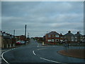
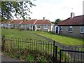
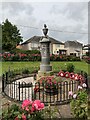
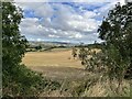
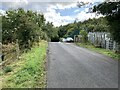
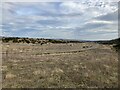
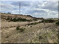

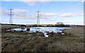
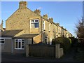
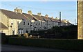
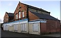
28 photos from this area
Area Information
Key information about the NE21 4NL including its size, population, and administrative classification.
- Area Type
- Postcode
- Area Size
- 8.9 hectares
- Population
- 1503
- Population Density
- 1112 people/km²
House Prices in NE21 4NL
14
Properties
£103,417
Average Sold Price
£75,000
Lowest Price
£129,000
Highest Price
Showing 14 properties
| Address | Type | Beds | Baths | Last Sale Price | Last Sale Date | |
|---|---|---|---|---|---|---|
| 15 Hedgefield Avenue, Hedgefield, Ryton, NE21 4NL | Terraced | 1 | 1 | £100,000 | Jul 2024 | |
| 4 Hedgefield Avenue, Hedgefield, Ryton, NE21 4NL | Retail | 2 | 1 | £85,000 | Apr 2022 | |
| 8 Hedgefield Avenue, Hedgefield, Ryton, NE21 4NL | house | - | - | £110,000 | Nov 2014 | |
| 2 Hedgefield Avenue, Hedgefield, Ryton, NE21 4NL | house | - | - | £100,000 | Oct 2010 | |
| 13 Hedgefield Avenue, Hedgefield, Ryton, NE21 4NL | Terraced | - | - | £124,800 | Nov 2008 | |
| 3 Hedgefield Avenue, Hedgefield, Ryton, NE21 4NL | Terraced | 2 | 1 | £122,000 | Nov 2007 | |
| 5 Hedgefield Avenue, Hedgefield, Ryton, NE21 4NL | Terraced | 2 | 1 | £129,000 | Nov 2006 | |
| 1 Hedgefield Avenue, Hedgefield, Ryton, NE21 4NL | house | - | - | £84,950 | Dec 2002 | |
| 9 Hedgefield Avenue, Hedgefield, Ryton, NE21 4NL | Terraced | 2 | 1 | £75,000 | Sep 2002 | |
| 14 Hedgefield Avenue, Hedgefield, Ryton, NE21 4NL | house | 2 | 1 | - | - |
Page 1 of 2
Energy Efficiency in NE21 4NL
Amenities
Schools
| Rank | School | Type | Entry gender | Ages |
|---|
Explore more schools in this area
Go to Schools tabDemographics
Household Size
Two person
most common
Accommodation Type
Houses
most common
Tenure
83
majority
Ethnic Group
White
most common
Religion
N/A
most common
Household Composition
N/A
most common
Age
47
median
Elderly (65+ years)
most common
Household Deprivation
N/A
with no deprivation
NS-SEC
37
in Lower managerial occupations
Explore more demographic insights in this area
Go to Demographics tabPlanning
Planning Constraints
- Flood RiskPremium
- Ramsar Wetland SitesPremium
- Area of Outstanding Natural BeautyPremium
- Protected Nature ReservePremium
- Protected WoodlandPremium