Area Overview for NE20 9LS
Photos of NE20 9LS

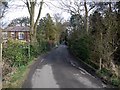


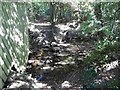
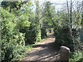


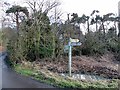

12 photos from this area
Area Information
Key information about the NE20 9LS including its size, population, and administrative classification.
- Area Type
- Postcode
- Area Size
- 3.6 hectares
- Population
- 2008
- Population Density
- 203 people/km²
House Prices in NE20 9LS
28
Properties
£448,663
Average Sold Price
£121,500
Lowest Price
£870,000
Highest Price
Showing 28 properties
| Address | Type | Beds | Baths | Last Sale Price | Last Sale Date | |
|---|---|---|---|---|---|---|
| 10 Westsyde, Darras Hall, Ponteland, NE20 9LS | Detached | 4 | 2 | £571,000 | Jul 2024 | |
| 9 Westsyde, Darras Hall, Ponteland, NE20 9LS | Detached | 4 | 2 | £550,000 | Jul 2024 | |
| 8 Westsyde, Darras Hall, Ponteland, NE20 9LS | Detached | 5 | 2 | £665,000 | Dec 2023 | |
| 28 Westsyde, Darras Hall, Ponteland, NE20 9LS | house | 5 | 4 | £850,000 | Oct 2023 | |
| Westsyde House, 27 Westsyde, Darras Hall, Ponteland, NE20 9LS | Detached | 3 | 1 | £870,000 | Sep 2023 | |
| 5 Westsyde, Darras Hall, Ponteland, NE20 9LS | house | - | - | £535,000 | May 2022 | |
| 19 Westsyde, Darras Hall, Ponteland, NE20 9LS | Bungalow | 3 | 1 | £450,000 | Oct 2021 | |
| 7 Westsyde, Darras Hall, Ponteland, NE20 9LS | house | - | - | £517,500 | Nov 2020 | |
| 26 Westsyde, Darras Hall, Ponteland, NE20 9LS | Detached | 4 | 2 | £430,000 | Jun 2018 | |
| 6 Westsyde, Darras Hall, Ponteland, NE20 9LS | Detached | 4 | 2 | £411,500 | Jul 2017 |
Page 1 of 3
Energy Efficiency in NE20 9LS
Amenities
Schools
| Rank | School | Type | Entry gender | Ages |
|---|
Explore more schools in this area
Go to Schools tabDemographics
Household Size
Family (3-5 people)
most common
Accommodation Type
Houses
most common
Tenure
94
majority
Ethnic Group
White
most common
Religion
N/A
most common
Household Composition
N/A
most common
Age
47
median
Adults (30-64 years)
most common
Household Deprivation
N/A
with no deprivation
NS-SEC
56
in Lower managerial occupations
Explore more demographic insights in this area
Go to Demographics tabPlanning
Planning Constraints
- Flood RiskPremium
- Ramsar Wetland SitesPremium
- Area of Outstanding Natural BeautyPremium
- Protected Nature ReservePremium
- Protected WoodlandPremium