Area Overview for NE20 9LB
Photos of NE20 9LB
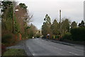
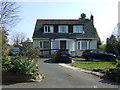

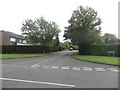

5 photos from this area
Area Information
Key information about the NE20 9LB including its size, population, and administrative classification.
- Area Type
- Postcode
- Area Size
- 1.2 hectares
- Population
- 1340
- Population Density
- 533 people/km²
House Prices in NE20 9LB
12
Properties
£314,071
Average Sold Price
£136,000
Lowest Price
£650,000
Highest Price
Showing 12 properties
| Address | Type | Beds | Baths | Last Sale Price | Last Sale Date | |
|---|---|---|---|---|---|---|
| 44 Errington Road, Darras Hall, Ponteland, NE20 9LB | Detached | 5 | 3 | £650,000 | Sep 2024 | |
| 54 Errington Road, Darras Hall, Ponteland, NE20 9LB | house | - | - | £485,000 | Aug 2020 | |
| 41 Errington Road, Darras Hall, Ponteland, NE20 9LB | house | - | - | £395,000 | Oct 2007 | |
| 43 Errington Road, Darras Hall, Ponteland, NE20 9LB | Semi-detached | - | - | £225,000 | Dec 2001 | |
| 47 Errington Road, Darras Hall, Ponteland, NE20 9LB | Detached | - | - | £160,000 | Aug 1999 | |
| 52 Errington Road, Darras Hall, Ponteland, NE20 9LB | Detached | 4 | - | £147,500 | Jun 1997 | |
| 45 Errington Road, Darras Hall, Ponteland, NE20 9LB | Detached | - | - | £136,000 | May 1997 | |
| 51 Errington Road, Darras Hall, Ponteland, NE20 9LB | Detached | 5 | 3 | - | - | |
| 50 Errington Road, Darras Hall, Ponteland, NE20 9LB | house | - | - | - | - | |
| 46 Errington Road, Darras Hall, Ponteland, NE20 9LB | Detached | - | - | - | - |
Page 1 of 2
Energy Efficiency in NE20 9LB
Amenities
Schools
| Rank | School | Type | Entry gender | Ages |
|---|
Explore more schools in this area
Go to Schools tabDemographics
Household Size
Two person
most common
Accommodation Type
Houses
most common
Tenure
95
majority
Ethnic Group
White
most common
Religion
N/A
most common
Household Composition
N/A
most common
Age
47
median
Adults (30-64 years)
most common
Household Deprivation
N/A
with no deprivation
NS-SEC
57
in Lower managerial occupations
Explore more demographic insights in this area
Go to Demographics tabPlanning
Planning Constraints
- Flood RiskPremium
- Ramsar Wetland SitesPremium
- Area of Outstanding Natural BeautyPremium
- Protected Nature ReservePremium
- Protected WoodlandPremium