Area Overview for NE2 4AA
Photos of NE2 4AA
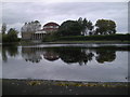
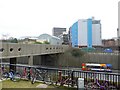
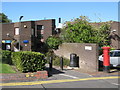
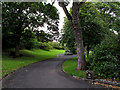
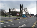
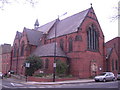

100 photos from this area
Area Information
Key information about the NE2 4AA including its size, population, and administrative classification.
- Area Type
- Postcode
- Area Size
- 2.2 hectares
- Population
- 3573
- Population Density
- 1905 people/km²
House Prices in NE2 4AA
100
Properties
£3,786,000
Average Sold Price
£68,000
Lowest Price
£10,900,000
Highest Price
Showing 100 properties
| Address | Type | Beds | Baths | Last Sale Price | Last Sale Date | |
|---|---|---|---|---|---|---|
| 26 Claremont Place, Newcastle Upon Tyne, NE2 4AA | studentAccommodation | - | - | £10,900,000 | Dec 2016 | |
| 30 Claremont Place, Newcastle Upon Tyne, NE2 4AA | Detached | 4 | - | £390,000 | Aug 2003 | |
| 32 Claremont Place, Newcastle Upon Tyne, NE2 4AA | Flat | 1 | 1 | £68,000 | Jun 1997 | |
| 28A Claremont Place, Newcastle Upon Tyne, NE2 4AA | Flat | - | - | - | - | |
| 29A Claremont Place, Newcastle Upon Tyne, NE2 4AA | Flat | - | - | - | - | |
| 27A Claremont Place, Newcastle Upon Tyne, NE2 4AA | Terraced | - | - | - | - | |
| 28D Claremont Place, Newcastle Upon Tyne, NE2 4AA | Flat | - | - | - | - | |
| 28C Claremont Place, Newcastle Upon Tyne, NE2 4AA | Flat | - | - | - | - | |
| 22 Claremont Place, Newcastle Upon Tyne, NE2 4AA | Flat | - | - | - | - | |
| 23 Claremont Place, Newcastle Upon Tyne, NE2 4AA | Flat | - | - | - | - |
Page 1 of 10
Energy Efficiency in NE2 4AA
Amenities
Schools
| Rank | School | Type | Entry gender | Ages |
|---|
Explore more schools in this area
Go to Schools tabDemographics
Household Size
One person
most common
Accommodation Type
Flats
most common
Tenure
16
majority
Ethnic Group
White
most common
Religion
N/A
most common
Household Composition
N/A
most common
Age
22
median
Young Adults (15-29 years)
most common
Household Deprivation
N/A
with no deprivation
NS-SEC
12
in Lower managerial occupations
Explore more demographic insights in this area
Go to Demographics tabPlanning
Planning Constraints
- Flood RiskPremium
- Ramsar Wetland SitesPremium
- Area of Outstanding Natural BeautyPremium
- Protected Nature ReservePremium
- Protected WoodlandPremium