Area Overview for NE2 2TB
Photos of NE2 2TB
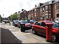
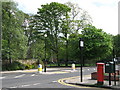
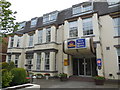
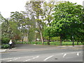


100 photos from this area
Area Information
Key information about the NE2 2TB including its size, population, and administrative classification.
- Area Type
- Postcode
- Area Size
- 9736 m²
- Population
- 1804
- Population Density
- 14083 people/km²
House Prices in NE2 2TB
43
Properties
£293,500
Average Sold Price
£275,000
Lowest Price
£312,000
Highest Price
Showing 43 properties
| Address | Type | Beds | Baths | Last Sale Price | Last Sale Date | |
|---|---|---|---|---|---|---|
| 143 Osborne Road, Jesmond, Newcastle Upon Tyne, NE2 2TB | Terraced | 7 | 3 | £312,000 | Jul 2013 | |
| 141 Osborne Road, Jesmond, Newcastle Upon Tyne, NE2 2TB | Terraced | 6 | 2 | £275,000 | Feb 2009 | |
| Flat 3, 121 Osborne Road, Jesmond, Newcastle Upon Tyne, NE2 2TB | Flat | 2 | 1 | - | - | |
| Flat 7, 139 Osborne Road, Jesmond, Newcastle Upon Tyne, NE2 2TB | Flat | 2 | 2 | - | - | |
| Flat 2, Regency Court, 135 Osborne Road, Jesmond, Newcastle Upon Tyne, NE2 2TB | Flat | 2 | 1 | - | - | |
| Flat 3, 133 Osborne Road, Jesmond, Newcastle Upon Tyne, NE2 2TB | Flat | 2 | 1 | - | - | |
| Flat 5, Saint Georges Court, 123 Osborne Road, Jesmond, Newcastle Upon Tyne, NE2 2TB | Flat | - | - | - | - | |
| Flat 5, 131 Osborne Road, Jesmond, Newcastle Upon Tyne, NE2 2TB | Flat | - | - | - | - | |
| Flat 1, 139 Osborne Road, Jesmond, Newcastle Upon Tyne, NE2 2TB | Flat | 1 | - | - | - | |
| Flat 1, 121 Osborne Road, Jesmond, Newcastle Upon Tyne, NE2 2TB | Flat | 1 | - | - | - |
Page 1 of 5
Energy Efficiency in NE2 2TB
Amenities
Schools
| Rank | School | Type | Entry gender | Ages |
|---|
Explore more schools in this area
Go to Schools tabDemographics
Household Size
One person
most common
Accommodation Type
Flats
most common
Tenure
25
majority
Ethnic Group
White
most common
Religion
N/A
most common
Household Composition
N/A
most common
Age
22
median
Young Adults (15-29 years)
most common
Household Deprivation
N/A
with no deprivation
NS-SEC
20
in Lower managerial occupations
Explore more demographic insights in this area
Go to Demographics tabPlanning
Planning Constraints
- Flood RiskPremium
- Ramsar Wetland SitesPremium
- Area of Outstanding Natural BeautyPremium
- Protected Nature ReservePremium
- Protected WoodlandPremium