Area Overview for NE2 2JR
Photos of NE2 2JR
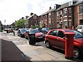
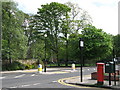

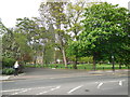

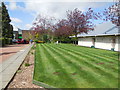
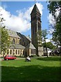
100 photos from this area
Area Information
Key information about the NE2 2JR including its size, population, and administrative classification.
- Area Type
- Postcode
- Area Size
- 8379 m²
- Population
- 2124
- Population Density
- 10760 people/km²
House Prices in NE2 2JR
28
Properties
£331,726
Average Sold Price
£143,000
Lowest Price
£516,000
Highest Price
Showing 28 properties
| Address | Type | Beds | Baths | Last Sale Price | Last Sale Date | |
|---|---|---|---|---|---|---|
| 19 Hartside Gardens, Jesmond, Newcastle Upon Tyne, NE2 2JR | house | - | - | £516,000 | Nov 2024 | |
| 13 Hartside Gardens, Jesmond, Newcastle Upon Tyne, NE2 2JR | Semi-detached | 3 | 1 | £467,500 | Aug 2023 | |
| 21 Hartside Gardens, Jesmond, Newcastle Upon Tyne, NE2 2JR | house | 3 | - | £510,000 | Feb 2023 | |
| 23 Hartside Gardens, Jesmond, Newcastle Upon Tyne, NE2 2JR | house | 3 | 1 | £407,000 | Feb 2023 | |
| 12 Hartside Gardens, Jesmond, Newcastle Upon Tyne, NE2 2JR | Semi-detached | 3 | 1 | £375,000 | Dec 2021 | |
| 20 Hartside Gardens, Jesmond, Newcastle Upon Tyne, NE2 2JR | Semi-detached | 3 | 1 | £392,500 | Apr 2021 | |
| 2 Hartside Gardens, Jesmond, Newcastle Upon Tyne, NE2 2JR | house | 3 | 1 | £365,000 | Sep 2019 | |
| 31 Hartside Gardens, Jesmond, Newcastle Upon Tyne, NE2 2JR | house | - | - | £370,000 | Nov 2018 | |
| 14 Hartside Gardens, Jesmond, Newcastle Upon Tyne, NE2 2JR | Semi-detached | 4 | - | £365,000 | Jul 2014 | |
| 22 Hartside Gardens, Jesmond, Newcastle Upon Tyne, NE2 2JR | Terraced | 3 | - | £243,000 | Jun 2012 |
Page 1 of 3
Energy Efficiency in NE2 2JR
Amenities
Schools
| Rank | School | Type | Entry gender | Ages |
|---|
Explore more schools in this area
Go to Schools tabDemographics
Household Size
Family (3-5 people)
most common
Accommodation Type
Houses
most common
Tenure
35
majority
Ethnic Group
White
most common
Religion
N/A
most common
Household Composition
N/A
most common
Age
22
median
Young Adults (15-29 years)
most common
Household Deprivation
N/A
with no deprivation
NS-SEC
21
in Lower managerial occupations
Explore more demographic insights in this area
Go to Demographics tabPlanning
Planning Constraints
- Flood RiskPremium
- Ramsar Wetland SitesPremium
- Area of Outstanding Natural BeautyPremium
- Protected Nature ReservePremium
- Protected WoodlandPremium