Area Overview for NE2 2DJ
Photos of NE2 2DJ
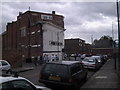
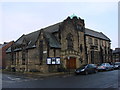
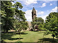
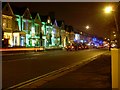
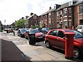
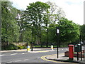
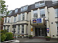
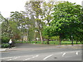

100 photos from this area
Area Information
Key information about the NE2 2DJ including its size, population, and administrative classification.
- Area Type
- Postcode
- Area Size
- 7358 m²
- Population
- 1804
- Population Density
- 14083 people/km²
House Prices in NE2 2DJ
6
Properties
£850,000
Average Sold Price
£850,000
Lowest Price
£850,000
Highest Price
Showing 6 properties
| Address | Type | Beds | Baths | Last Sale Price | Last Sale Date | |
|---|---|---|---|---|---|---|
| 31 Acorn Road, Jesmond, Newcastle Upon Tyne, NE2 2DJ | Maisonette | 6 | - | £850,000 | Sep 2022 | |
| Clarkson Events Collabs Ltd, Floor 1, 15 Acorn Road, Jesmond, Newcastle Upon Tyne, NE2 2DJ | Office | - | - | - | - | |
| Upper Floor, 44 Acorn Road, Jesmond, Newcastle Upon Tyne, NE2 2DJ | Retail | - | - | - | - | |
| Perfect Smile Upper Floor, 44 Acorn Road, Jesmond, Newcastle Upon Tyne, NE2 2DJ | primary_healthcare | - | - | - | - | |
| 35A Acorn Road, Jesmond, Newcastle Upon Tyne, NE2 2DJ | Maisonette | - | - | - | - | |
| 35B Acorn Road, Jesmond, Newcastle Upon Tyne, NE2 2DJ | Flat | - | - | - | - |
Energy Efficiency in NE2 2DJ
Amenities
Schools
| Rank | School | Type | Entry gender | Ages |
|---|
Explore more schools in this area
Go to Schools tabDemographics
Household Size
One person
most common
Accommodation Type
Flats
most common
Tenure
25
majority
Ethnic Group
White
most common
Religion
N/A
most common
Household Composition
N/A
most common
Age
22
median
Young Adults (15-29 years)
most common
Household Deprivation
N/A
with no deprivation
NS-SEC
20
in Lower managerial occupations
Explore more demographic insights in this area
Go to Demographics tabPlanning
Planning Constraints
- Flood RiskPremium
- Ramsar Wetland SitesPremium
- Area of Outstanding Natural BeautyPremium
- Protected Nature ReservePremium
- Protected WoodlandPremium