Area Overview for NE2 1NP
Photos of NE2 1NP


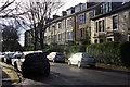
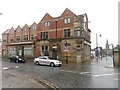
100 photos from this area
Area Information
Key information about the NE2 1NP including its size, population, and administrative classification.
- Area Type
- Postcode
- Area Size
- 1917 m²
- Population
- 1531
- Population Density
- 798664 people/km²
House Prices in NE2 1NP
16
Properties
£119,045
Average Sold Price
£49,950
Lowest Price
£345,000
Highest Price
Showing 16 properties
| Address | Type | Beds | Baths | Last Sale Price | Last Sale Date | |
|---|---|---|---|---|---|---|
| 205 Sandyford Road, Newcastle Upon Tyne, NE2 1NP | Flat | 2 | - | £122,500 | Sep 2023 | |
| 204 Sandyford Road, Newcastle Upon Tyne, NE2 1NP | Maisonette | 5 | 2 | £122,500 | Sep 2023 | |
| 210 Sandyford Road, Newcastle Upon Tyne, NE2 1NP | house | - | - | £345,000 | Jul 2019 | |
| 201 Sandyford Road, Newcastle Upon Tyne, NE2 1NP | Flat | 2 | 1 | £125,000 | Aug 2011 | |
| 199 Sandyford Road, Newcastle Upon Tyne, NE2 1NP | Flat | - | - | £104,500 | Apr 2011 | |
| 207 Sandyford Road, Newcastle Upon Tyne, NE2 1NP | Flat | - | - | £110,000 | Aug 2005 | |
| 198 Sandyford Road, Newcastle Upon Tyne, NE2 1NP | Maisonette | 5 | 2 | £87,000 | Nov 2000 | |
| 200 Sandyford Road, Newcastle Upon Tyne, NE2 1NP | Maisonette | 4 | 2 | £49,950 | Sep 1999 | |
| 206 Sandyford Road, Newcastle Upon Tyne, NE2 1NP | Maisonette | 3 | 1 | £72,000 | Jul 1997 | |
| 208 Sandyford Road, Newcastle Upon Tyne, NE2 1NP | Maisonette | 4 | 2 | £52,000 | Sep 1995 |
Page 1 of 2
Energy Efficiency in NE2 1NP
Amenities
Schools
| Rank | School | Type | Entry gender | Ages |
|---|
Explore more schools in this area
Go to Schools tabDemographics
Household Size
One person
most common
Accommodation Type
Flats
most common
Tenure
49
majority
Ethnic Group
White
most common
Religion
N/A
most common
Household Composition
N/A
most common
Age
22
median
Young Adults (15-29 years)
most common
Household Deprivation
N/A
with no deprivation
NS-SEC
39
in Lower managerial occupations
Explore more demographic insights in this area
Go to Demographics tabPlanning
Planning Constraints
- Flood RiskPremium
- Ramsar Wetland SitesPremium
- Area of Outstanding Natural BeautyPremium
- Protected Nature ReservePremium
- Protected WoodlandPremium