Area Overview for NE2 1HY
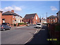
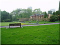
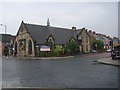
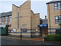
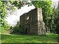
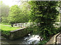
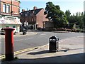
Photos of NE2 1HY


Area Information
NE2 1HY is a small residential postcode in England, home to 1,531 residents living in a compact cluster of properties. This area is characterised by its youthful demographic, with a median age of 22 and the majority of residents aged between 15 and 29. The community is largely composed of flats, reflecting a mix of owner-occupied and rental properties. Proximity to transport hubs and amenities makes it convenient for commuters and students. The area’s low crime risk score of 82 and excellent broadband connectivity of 91 support a practical lifestyle, ideal for those prioritising safety and digital access. With schools like St Catherine’s RC Primary School nearby, it appeals to families seeking a balance between urban accessibility and essential services. While the postcode is small, its integration with surrounding infrastructure ensures residents have access to retail, public transport, and ferry links, fostering a connected yet distinct local identity.
- Area Type
- Postcode
- Area Size
- Not available
- Population
- 1531
- Population Density
- 5738 people/km²
The property market in NE2 1HY is defined by its high concentration of flats, which dominate the housing stock. With 49% of residents owning their homes, the area balances owner-occupation with rental availability, though specific data on rental rates or property values is not provided. The prevalence of flats suggests a focus on compact, efficient living, likely catering to young professionals and students. Given the small postcode size, the immediate surroundings may offer limited housing diversity, making buyers reliant on nearby areas for alternative options. The market’s character is shaped by its urban context, with proximity to transport links and amenities enhancing its appeal for those prioritising location over property size.
House Prices in NE2 1HY
No properties found in this postcode.
Energy Efficiency in NE2 1HY
Living in NE2 1HY offers a blend of urban convenience and accessible amenities. Residents can shop at Sainsburys Newcastle, Spar Sandyford, and Tesco Stoddard, while nearby rail stations like Manors and Heworth provide links to the wider region. Metro stops such as Jesmond and Byker facilitate quick travel, and ferry terminals at Newcastle and South Shields open up coastal routes. The area’s proximity to multiple transport options, including buses and airports, enhances mobility. The presence of two primary schools and a young population fosters a community-oriented environment. While parks or leisure facilities are not explicitly detailed in the data, the area’s integration with transport and retail networks suggests a lifestyle focused on practicality and connectivity.
Amenities
Schools
Residents of NE2 1HY have access to two primary schools: St Catherine’s RC Primary School and St Catherine’s Catholic Primary School. Both institutions cater to younger children, offering foundational education in a religious setting. The presence of two primary schools within the area provides families with options, though data on Ofsted ratings or academic performance is not available. The concentration of primary schools suggests a community focused on family needs, with education a key consideration for homebuyers. For parents seeking early-years schooling, the proximity of these institutions reduces commuting time and supports a balanced lifestyle. However, the absence of secondary schools in the immediate vicinity may necessitate travel for older students.
| Rank | School | Type | Entry gender | Ages |
|---|
Explore more schools in this area
Go to Schools tabDemographics
The population of NE2 1HY is overwhelmingly young, with 49% of residents aged 15–29, reflecting a community skewed towards students, graduates, and early-career professionals. Home ownership stands at 49%, indicating a mix of owner-occupied and rental properties. The accommodation type is predominantly flats, a common feature in urban areas with limited space. The predominant ethnic group is White, though specific data on diversity is not provided. The median age of 22 suggests a dynamic, transient population, potentially influenced by nearby educational institutions or employment opportunities. This demographic profile shapes a lifestyle centred on affordability, convenience, and access to services. The low crime risk score of 82 further aligns with the needs of younger residents prioritising safety and stability in their living environment.
Household Size
Accommodation Type
Tenure
Ethnic Group
Religion
Household Composition
Age
Household Deprivation
NS-SEC
Explore more demographic insights in this area
Go to Demographics tabPlanning
Planning Constraints
- Flood RiskPremium
- Ramsar Wetland SitesPremium
- Area of Outstanding Natural BeautyPremium
- Protected Nature ReservePremium
- Protected WoodlandPremium