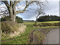
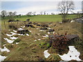
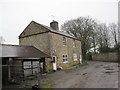
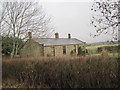
Area Overview for NE19 2EA
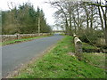
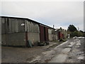
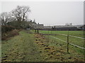
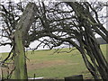
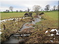
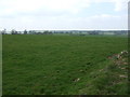
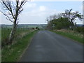
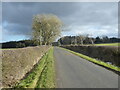
Photos of NE19 2EA
Area Information
Living in NE19 2EA offers a quiet, low-density residential experience in a small cluster of homes. With a population of 1,736 and just 10 people per square kilometre, the area feels spacious and unspoiled. The community is predominantly composed of adults aged 30–64, with a median age of 47, suggesting a mature, stable demographic. Most properties are owner-occupied, with 57% of homes owned by residents rather than rented. The area’s compact size means a tight-knit feel, where familiarity with neighbours is likely. Nearby, Belsay Primary School and Cambo First School (both rated ‘good’ by Ofsted) serve local families, while Gallowhill Hall Boarding Special School caters to specific educational needs. The absence of environmental constraints like AONB or protected woodlands means development pressures are minimal. Crime rates are exceptionally low, with a safety score of 88, and flood risk is negligible. For those seeking a peaceful, low-maintenance lifestyle with easy access to essential services, NE19 2EA presents a compelling case.
- Area Type
- Postcode
- Area Size
- Not available
- Population
- 1736
- Population Density
- 10 people/km²
The property market in NE19 2EA is defined by its low density and focus on owner-occupied homes. With 57% of properties owned by residents, the area is not a rental hotspot but rather a place where long-term residents have established roots. The predominance of houses over flats suggests larger, more private living spaces, which may appeal to families or those seeking space. Given the small population and limited housing stock, the market is likely to be niche, with fewer properties available compared to larger urban areas. Buyers should consider the area’s isolation, as its low population density may mean fewer amenities within walking distance. However, the absence of planning constraints and low environmental risks could make it an attractive option for those prioritising tranquillity over convenience.
House Prices in NE19 2EA
No properties found in this postcode.
Energy Efficiency in NE19 2EA
Amenities
Schools
NE19 2EA is served by a mix of primary and special schools, offering options for different educational needs. Belsay Primary School and Cambo First School are both primary institutions with ‘good’ Ofsted ratings, providing a solid foundation for younger children. Gallowhill Hall Boarding Special School caters to students with specific requirements, adding depth to the local education landscape. The presence of two primary schools with strong ratings is a significant draw for families, ensuring access to quality early education. However, the area lacks secondary schools, so older students may need to commute to nearby towns. This combination of mainstream and specialist education reflects a community that values inclusivity and tailored support for its residents.
| Rank | School | Type | Entry gender | Ages |
|---|
Explore more schools in this area
Go to Schools tabDemographics
NE19 2EA’s population of 1,736 is skewed toward adults aged 30–64, reflecting a mature community with a median age of 47. This suggests a demographic focused on long-term residency rather than transient populations. Home ownership is strong, with 57% of households owning their properties, indicating a stable, settled population. The area is dominated by houses, not flats, which aligns with its low density and rural character. The predominant ethnic group is White, though specific data on diversity is not provided. The absence of detailed deprivation metrics means it’s unclear how socioeconomic factors influence daily life, but the low crime score and minimal environmental risks imply a generally secure and stable environment. For families, the presence of two primary schools with ‘good’ Ofsted ratings offers reassurance about local education quality.
Household Size
Accommodation Type
Tenure
Ethnic Group
Religion
Household Composition
Age
Household Deprivation
NS-SEC
Explore more demographic insights in this area
Go to Demographics tabPlanning
Planning Constraints
- Flood RiskPremium
- Ramsar Wetland SitesPremium
- Area of Outstanding Natural BeautyPremium
- Protected Nature ReservePremium
- Protected WoodlandPremium