Area Overview for NE19 1TS
Photos of NE19 1TS
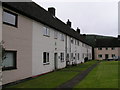
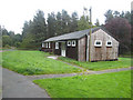
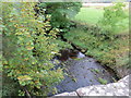

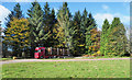
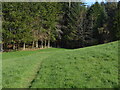
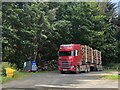
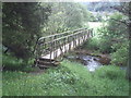
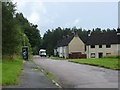
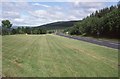

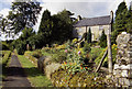
17 photos from this area
Area Information
Key information about the NE19 1TS including its size, population, and administrative classification.
- Area Type
- Postcode
- Area Size
- 1.1 hectares
- Population
- 1578
- Population Density
- 2 people/km²
House Prices in NE19 1TS
17
Properties
£90,329
Average Sold Price
£29,000
Lowest Price
£149,950
Highest Price
Showing 17 properties
| Address | Type | Beds | Baths | Last Sale Price | Last Sale Date | |
|---|---|---|---|---|---|---|
| 2 Otterburn Green, Byrness Village, NE19 1TS | Semi-detached | 3 | 1 | £107,923 | Sep 2025 | |
| 13 Otterburn Green, Byrness Village, NE19 1TS | Terraced | 3 | 2 | £130,000 | Jan 2022 | |
| 14 Otterburn Green, Byrness Village, NE19 1TS | Terraced | 3 | 2 | £149,950 | Nov 2017 | |
| 17 Otterburn Green, Byrness Village, NE19 1TS | house | 3 | - | £87,950 | Mar 2014 | |
| 1 Otterburn Green, Byrness Village, NE19 1TS | Terraced | 3 | 2 | £80,000 | Sep 2013 | |
| 15 Otterburn Green, Byrness Village, NE19 1TS | Terraced | 3 | - | £85,000 | Jul 2012 | |
| 11 Otterburn Green, Byrness Village, NE19 1TS | house | 3 | - | £119,950 | May 2005 | |
| 12 Otterburn Green, Byrness Village, NE19 1TS | Terraced | - | - | £88,000 | May 2005 | |
| 16 Otterburn Green, Byrness Village, NE19 1TS | Terraced | - | - | £85,000 | Jun 2004 | |
| 4 Otterburn Green, Byrness Village, NE19 1TS | Semi-detached | - | - | £87,500 | Mar 2004 |
Page 1 of 2
Energy Efficiency in NE19 1TS
Amenities
Schools
| Rank | School | Type | Entry gender | Ages |
|---|
Explore more schools in this area
Go to Schools tabDemographics
Household Size
Two person
most common
Accommodation Type
Houses
most common
Tenure
67
majority
Ethnic Group
White
most common
Religion
N/A
most common
Household Composition
N/A
most common
Age
47
median
Adults (30-64 years)
most common
Household Deprivation
N/A
with no deprivation
NS-SEC
28
in Lower managerial occupations
Explore more demographic insights in this area
Go to Demographics tabPlanning
Planning Constraints
- Flood RiskPremium
- Ramsar Wetland SitesPremium
- Area of Outstanding Natural BeautyPremium
- Protected Nature ReservePremium
- Protected WoodlandPremium