Area Overview for NE17 7EZ
Photos of NE17 7EZ
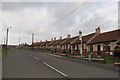
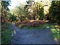
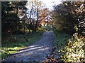
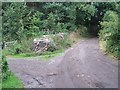
25 photos from this area
Area Information
Key information about the NE17 7EZ including its size, population, and administrative classification.
- Area Type
- Postcode
- Area Size
- 4.6 hectares
- Population
- 1557
- Population Density
- 395 people/km²
House Prices in NE17 7EZ
69
Properties
£132,072
Average Sold Price
£26,600
Lowest Price
£197,995
Highest Price
Showing 69 properties
| Address | Type | Beds | Baths | Last Sale Price | Last Sale Date | |
|---|---|---|---|---|---|---|
| 72 Valley Dene, Chopwell South, Chopwell, NE17 7EZ | Terraced | - | - | £120,000 | Oct 2025 | |
| 124 Valley Dene, Chopwell South, Chopwell, NE17 7EZ | Detached | 3 | 1 | £169,000 | Sep 2025 | |
| 85 Valley Dene, Chopwell South, Chopwell, NE17 7EZ | Semi-detached | 3 | 1 | £166,000 | Jul 2025 | |
| 90 Valley Dene, Chopwell South, Chopwell, NE17 7EZ | house | 3 | - | £140,000 | Jan 2023 | |
| 66 Valley Dene, Chopwell South, Chopwell, NE17 7EZ | house | - | - | £146,500 | Dec 2022 | |
| 78 Valley Dene, Chopwell South, Chopwell, NE17 7EZ | house | - | - | £150,000 | Nov 2022 | |
| 83 Valley Dene, Chopwell South, Chopwell, NE17 7EZ | Detached | 3 | 1 | £131,995 | Jun 2022 | |
| 122 Valley Dene, Chopwell South, Chopwell, NE17 7EZ | house | - | - | £165,995 | Jun 2022 | |
| 81 Valley Dene, Chopwell South, Chopwell, NE17 7EZ | house | - | - | £166,995 | Jun 2022 | |
| 79 Valley Dene, Chopwell South, Chopwell, NE17 7EZ | house | - | - | £197,995 | Jun 2022 |
Page 1 of 7
Energy Efficiency in NE17 7EZ
Amenities
Schools
| Rank | School | Type | Entry gender | Ages |
|---|
Explore more schools in this area
Go to Schools tabDemographics
Household Size
One person
most common
Accommodation Type
Houses
most common
Tenure
54
majority
Ethnic Group
White
most common
Religion
N/A
most common
Household Composition
N/A
most common
Age
47
median
Adults (30-64 years)
most common
Household Deprivation
N/A
with no deprivation
NS-SEC
23
in Lower managerial occupations
Explore more demographic insights in this area
Go to Demographics tabPlanning
Planning Constraints
- Flood RiskPremium
- Ramsar Wetland SitesPremium
- Area of Outstanding Natural BeautyPremium
- Protected Nature ReservePremium
- Protected WoodlandPremium