Area Overview for NE17 7DL
Photos of NE17 7DL
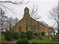
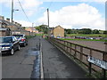
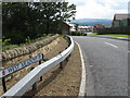
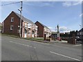
37 photos from this area
Area Information
Key information about the NE17 7DL including its size, population, and administrative classification.
- Area Type
- Postcode
- Area Size
- 6710 m²
- Population
- 1778
- Population Density
- 1330 people/km²
House Prices in NE17 7DL
53
Properties
£44,691
Average Sold Price
£12,500
Lowest Price
£76,000
Highest Price
Showing 53 properties
| Address | Type | Beds | Baths | Last Sale Price | Last Sale Date | |
|---|---|---|---|---|---|---|
| 39 Tweed Street, Chopwell North, Chopwell, NE17 7DL | Terraced | 2 | 1 | £38,000 | Sep 2025 | |
| 46 Tweed Street, Chopwell North, Chopwell, NE17 7DL | house | 3 | - | £47,500 | Jun 2025 | |
| 40 Tweed Street, Chopwell North, Chopwell, NE17 7DL | Terraced | 2 | 1 | £64,000 | Apr 2025 | |
| 1 Tweed Street, Chopwell North, Chopwell, NE17 7DL | house | 2 | 1 | £38,000 | Aug 2024 | |
| 21 Tweed Street, Chopwell North, Chopwell, NE17 7DL | Terraced | 3 | 1 | £50,000 | Jun 2024 | |
| 34 Tweed Street, Chopwell North, Chopwell, NE17 7DL | Terraced | 2 | 1 | £43,500 | May 2024 | |
| 41 Tweed Street, Chopwell North, Chopwell, NE17 7DL | Terraced | 2 | 1 | £42,000 | Mar 2024 | |
| 15 Tweed Street, Chopwell North, Chopwell, NE17 7DL | Terraced | 2 | 1 | £39,950 | May 2023 | |
| 37 Tweed Street, Chopwell North, Chopwell, NE17 7DL | Terraced | 2 | 1 | £38,750 | Dec 2022 | |
| 7 Tweed Street, Chopwell North, Chopwell, NE17 7DL | Terraced | 2 | 1 | £45,500 | Jun 2022 |
Page 1 of 6
Energy Efficiency in NE17 7DL
Amenities
Schools
| Rank | School | Type | Entry gender | Ages |
|---|
Explore more schools in this area
Go to Schools tabDemographics
Household Size
One person
most common
Accommodation Type
Houses
most common
Tenure
54
majority
Ethnic Group
White
most common
Religion
N/A
most common
Household Composition
N/A
most common
Age
47
median
Adults (30-64 years)
most common
Household Deprivation
N/A
with no deprivation
NS-SEC
23
in Lower managerial occupations
Explore more demographic insights in this area
Go to Demographics tabPlanning
Planning Constraints
- Flood RiskPremium
- Ramsar Wetland SitesPremium
- Area of Outstanding Natural BeautyPremium
- Protected Nature ReservePremium
- Protected WoodlandPremium