Area Overview for NE16 9AS
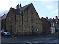
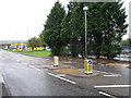
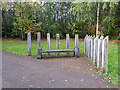
Photos of NE16 9AS


Area Information
Living in NE16 9AS means inhabiting a compact, residential postcode area in England with a population of 1,540 people. The density of 505 people per square kilometre suggests a tightly knit community, though the area’s small size means it is not a sprawling suburb. This postcode sits at the edge of larger urban centres, offering a quiet, residential character with proximity to transport hubs. Daily life here is shaped by its modest scale — a place where familiarity with neighbours is common, and local amenities are within practical reach. The area’s demographics reflect a mature population, with a median age of 47 and a strong presence of adults aged 30–64. This suggests a community focused on stability, with many residents owning their homes. While there are no major landmarks or attractions within the postcode itself, its strategic location near rail and metro lines connects it to broader regional opportunities, making it a practical choice for commuters or those seeking a balance between urban access and residential calm.
- Area Type
- Postcode
- Area Size
- Not available
- Population
- 1540
- Population Density
- 505 people/km²
The property market in NE16 9AS is dominated by owner-occupied homes, with 75% of residents living in houses rather than flats or apartments. This suggests a market skewed towards family homes and long-term residency, with limited rental activity. The prevalence of houses indicates a focus on traditional, single-family dwellings, which may appeal to buyers seeking space and stability. Given the area’s small size and compact layout, the housing stock is likely limited in volume, meaning competition for properties could be keen. Buyers should consider that the area is not a large estate or development but a tightly defined postcode cluster. The lack of high-rise or multi-unit buildings implies a more subdued, suburban feel, with properties likely to have gardens or outdoor space. For those prioritising proximity to transport links, the area’s rail and metro connections may offset its modest scale, making it attractive to commuters.
House Prices in NE16 9AS
No properties found in this postcode.
Energy Efficiency in NE16 9AS
The lifestyle in NE16 9AS is shaped by its accessible amenities, which include five retail outlets such as Morrisons Blaydon, Iceland Blaydon, and Lidl Lemington. These shops provide everyday essentials, reducing the need for long trips to larger centres. The area’s rail and metro stations — including Blaydon, Metrocentre, and Dunston — connect residents to broader networks, facilitating access to workplaces, cultural hubs, and leisure opportunities. Newcastle Airport is also within reach, adding to the area’s travel convenience. While the postcode itself is small, its proximity to transport links means residents can enjoy the benefits of urban life without the congestion of a city centre. The mix of retail, transport, and regional connectivity ensures daily life is practical and efficient, with no significant gaps in local services.
Amenities
Schools
The nearest school to NE16 9AS is Blaydon Comprehensive School, a primary institution. While no secondary schools are listed in the data, the presence of a primary school suggests the area is well-served for younger children’s education. Families with children under 11 may find this a key advantage, though those requiring secondary schooling may need to look beyond the immediate postcode. The absence of further schools in the data does not necessarily reflect the full range of educational options available, but it highlights the need for prospective buyers to investigate nearby districts for secondary education. The single school listed indicates a focus on primary-level needs, which could be sufficient for families with younger children but may require additional planning for older students.
| Rank | School | Type | Entry gender | Ages |
|---|
Explore more schools in this area
Go to Schools tabDemographics
NE16 9AS has a median age of 47, with the majority of residents falling within the 30–64 age range. This indicates a mature, settled population, likely with established careers and family structures. Home ownership is high at 75%, suggesting a stable housing market where most residents are long-term occupants rather than renters. The area is predominantly composed of houses, not flats, which aligns with the demographic profile of older, family-oriented households. The predominant ethnic group is White, which reflects broader regional patterns in the north-east of England. With a population of 1,540, the community is small enough to foster a sense of cohesion but not so insular that it lacks diversity. The age distribution and ownership rates imply a low turnover of residents, contributing to a consistent local character. However, the lack of specific data on deprivation or socioeconomic diversity means the area’s full social fabric remains partially unexplored.
Household Size
Accommodation Type
Tenure
Ethnic Group
Religion
Household Composition
Age
Household Deprivation
NS-SEC
Explore more demographic insights in this area
Go to Demographics tabPlanning
Planning Constraints
- Flood RiskPremium
- Ramsar Wetland SitesPremium
- Area of Outstanding Natural BeautyPremium
- Protected Nature ReservePremium
- Protected WoodlandPremium